KURK Kurchatov, Kazakhstan - Earthquake Result Viewer
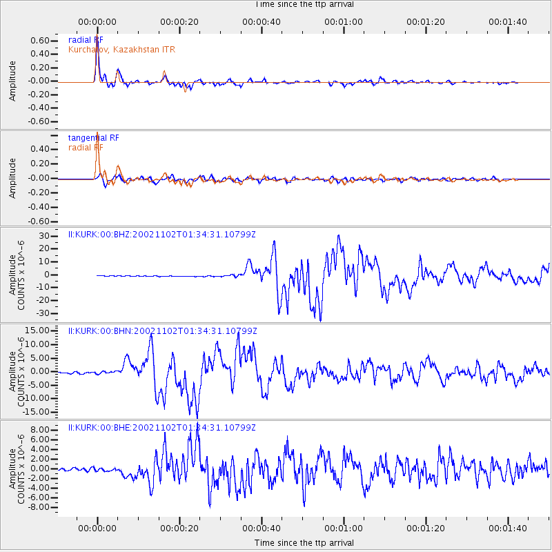
Earthquake location: Northern Sumatra, Indonesia
Earthquake latitude/longitude: 2.8/96.1
Earthquake time(UTC): 2002/11/02 (306) 01:26:10 GMT
Earthquake Depth: 30 km
Earthquake Magnitude: 6.2 MB, 7.6 MS, 7.4 MW, 7.4 MW
Earthquake Catalog/Contributor: WHDF/NEIC
Network: II Global Seismograph Network (GSN - IRIS/IDA)
Station: KURK Kurchatov, Kazakhstan
Lat/Lon: 50.72 N/78.62 E
Elevation: 184 m
Distance: 49.9 deg
Az: 345.567 deg
Baz: 156.946 deg
Ray Param: 0.06832188
Estimated Moho Depth: 41.25 km
Estimated Crust Vp/Vs: 1.80
Assumed Crust Vp: 6.552 km/s
Estimated Crust Vs: 3.635 km/s
Estimated Crust Poisson's Ratio: 0.28
Radial Match: 97.78584 %
Radial Bump: 353
Transverse Match: 90.616974 %
Transverse Bump: 400
SOD ConfigId: 4714
Insert Time: 2010-03-01 21:58:59.389 +0000
GWidth: 2.5
Max Bumps: 400
Tol: 0.001

Signal To Noise

ChannelStoNSTALTA
II:KURK:00:BHN:20021102T01:34:31.10799Z1.77823964.6304385E-72.6039453E-7
II:KURK:00:BHE:20021102T01:34:31.10799Z1.04098562.748167E-72.6399667E-7
II:KURK:00:BHZ:20021102T01:34:31.10799Z3.14627627.2431214E-72.3021252E-7
Arrivals
Ps5.4 SECOND
PpPs17 SECOND
PsPs/PpSs22 SECOND