You are here: Home > Network List > TA - USArray Transportable Network (new EarthScope stations) Stations List
> Station P56A Dayton Farm, Ripley, WV, USA > Earthquake Result Viewer
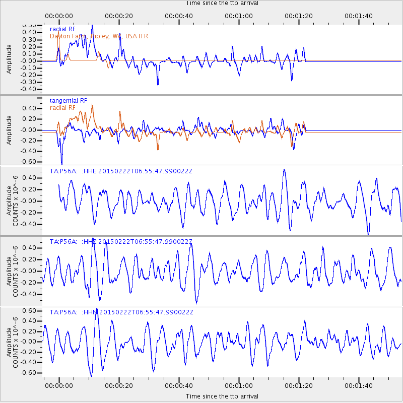
P56A Dayton Farm, Ripley, WV, USA - Earthquake Result Viewer
*The percent match for this event was below the threshold and hence no stack was calculated.
| Earthquake location: |
Northern Xinjiang, China |
| Earthquake latitude/longitude: |
44.1/85.6 |
| Earthquake time(UTC): |
2015/02/22 (053) 06:42:54 GMT |
| Earthquake Depth: |
12 km |
| Earthquake Magnitude: |
5.0 MW |
| Earthquake Catalog/Contributor: |
ISC/ISC |
|
| Network: |
TA USArray Transportable Network (new EarthScope stations) |
| Station: |
P56A Dayton Farm, Ripley, WV, USA |
| Lat/Lon: |
39.50 N/78.84 W |
| Elevation: |
249 m |
|
| Distance: |
95.6 deg |
| Az: |
347.935 deg |
| Baz: |
11.232 deg |
| Ray Param: |
$rayparam |
*The percent match for this event was below the threshold and hence was not used in the summary stack. |
|
| Radial Match: |
47.5443 % |
| Radial Bump: |
400 |
| Transverse Match: |
55.154453 % |
| Transverse Bump: |
293 |
| SOD ConfigId: |
7019011 |
| Insert Time: |
2019-04-17 00:25:12.602 +0000 |
| GWidth: |
2.5 |
| Max Bumps: |
400 |
| Tol: |
0.001 |
|
Signal To Noise
| Channel | StoN | STA | LTA |
| TA:P56A: :HHZ:20150222T06:55:47.990022Z | 0.72347385 | 1.5214077E-7 | 2.1029201E-7 |
| TA:P56A: :HHN:20150222T06:55:47.990022Z | 0.8174499 | 1.7801045E-7 | 2.1776314E-7 |
| TA:P56A: :HHE:20150222T06:55:47.990022Z | 0.55408216 | 9.746447E-8 | 1.7590257E-7 |
| Arrivals |
| Ps | |
| PpPs | |
| PsPs/PpSs | |


