KURK Kurchatov, Kazakhstan - Earthquake Result Viewer
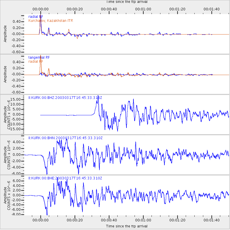
Earthquake location: Rat Islands, Aleutian Islands
Earthquake latitude/longitude: 51.3/178.0
Earthquake time(UTC): 2003/03/17 (076) 16:36:17 GMT
Earthquake Depth: 33 km
Earthquake Magnitude: 5.9 MB, 6.7 MS, 7.0 MW, 7.0 MW
Earthquake Catalog/Contributor: WHDF/NEIC
Network: II Global Seismograph Network (GSN - IRIS/IDA)
Station: KURK Kurchatov, Kazakhstan
Lat/Lon: 50.72 N/78.62 E
Elevation: 184 m
Distance: 57.6 deg
Az: 312.027 deg
Baz: 47.224 deg
Ray Param: 0.06332422
Estimated Moho Depth: 39.25 km
Estimated Crust Vp/Vs: 1.75
Assumed Crust Vp: 6.552 km/s
Estimated Crust Vs: 3.739 km/s
Estimated Crust Poisson's Ratio: 0.26
Radial Match: 98.87855 %
Radial Bump: 274
Transverse Match: 93.895645 %
Transverse Bump: 400
SOD ConfigId: 4714
Insert Time: 2010-03-01 21:59:45.580 +0000
GWidth: 2.5
Max Bumps: 400
Tol: 0.001

Signal To Noise

ChannelStoNSTALTA
II:KURK:00:BHN:20030317T16:45:33.310Z33.4576152.5140018E-67.51399E-8
II:KURK:00:BHE:20030317T16:45:33.310Z41.7773253.1890677E-67.63349E-8
II:KURK:00:BHZ:20030317T16:45:33.310Z92.155038.02606E-68.709302E-8
Arrivals
Ps4.7 SECOND
PpPs16 SECOND
PsPs/PpSs20 SECOND