You are here: Home > Network List > US - United States National Seismic Network Stations List
> Station DGMT Dagmar, Montana, USA > Earthquake Result Viewer
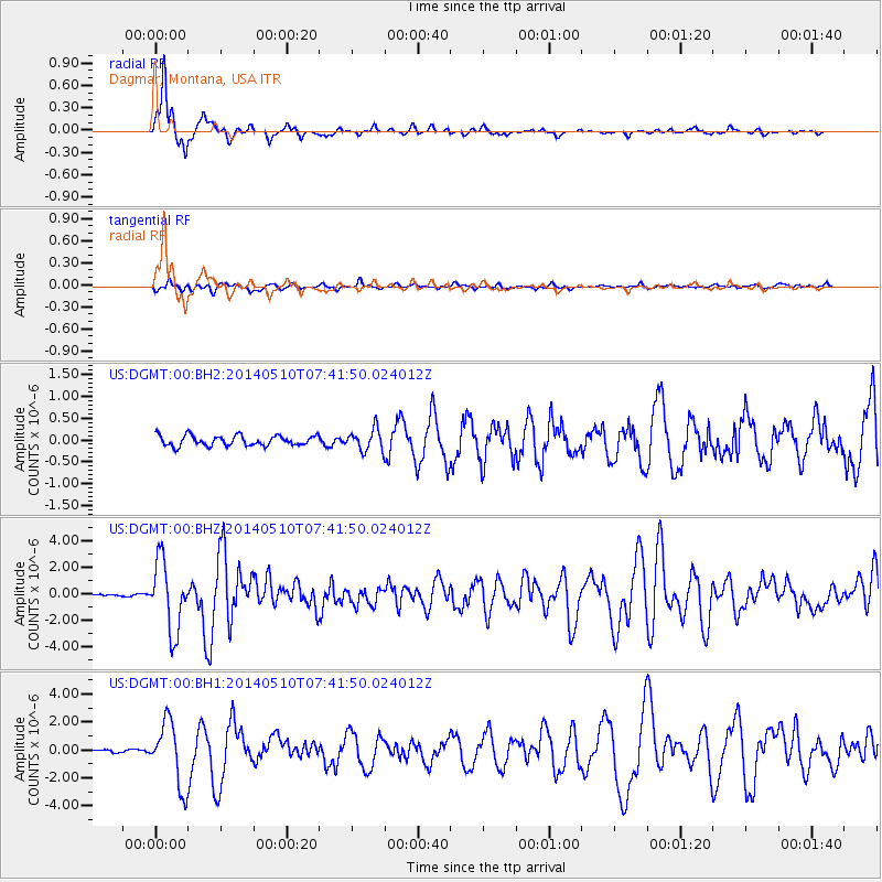
DGMT Dagmar, Montana, USA - Earthquake Result Viewer
*The percent match for this event was below the threshold and hence no stack was calculated.
| Earthquake location: |
Guerrero, Mexico |
| Earthquake latitude/longitude: |
17.3/-100.8 |
| Earthquake time(UTC): |
2014/05/10 (130) 07:36:03 GMT |
| Earthquake Depth: |
35 km |
| Earthquake Magnitude: |
6.0 MB |
| Earthquake Catalog/Contributor: |
NEIC PDE/NEIC COMCAT |
|
| Network: |
US United States National Seismic Network |
| Station: |
DGMT Dagmar, Montana, USA |
| Lat/Lon: |
48.47 N/104.20 W |
| Elevation: |
0.0 m |
|
| Distance: |
31.3 deg |
| Az: |
355.584 deg |
| Baz: |
173.653 deg |
| Ray Param: |
$rayparam |
*The percent match for this event was below the threshold and hence was not used in the summary stack. |
|
| Radial Match: |
91.17385 % |
| Radial Bump: |
254 |
| Transverse Match: |
64.798225 % |
| Transverse Bump: |
400 |
| SOD ConfigId: |
626651 |
| Insert Time: |
2014-05-24 08:51:30.724 +0000 |
| GWidth: |
2.5 |
| Max Bumps: |
400 |
| Tol: |
0.001 |
|
Signal To Noise
| Channel | StoN | STA | LTA |
| US:DGMT:00:BHZ:20140510T07:41:50.024012Z | 25.224941 | 2.634622E-6 | 1.04445114E-7 |
| US:DGMT:00:BH1:20140510T07:41:50.024012Z | 15.437973 | 2.2724E-6 | 1.471955E-7 |
| US:DGMT:00:BH2:20140510T07:41:50.024012Z | 2.0967069 | 2.4524002E-7 | 1.1696437E-7 |
| Arrivals |
| Ps | |
| PpPs | |
| PsPs/PpSs | |


