You are here: Home > Network List > TA - USArray Transportable Network (new EarthScope stations) Stations List
> Station A04D Lummi Island, WA, USA > Earthquake Result Viewer
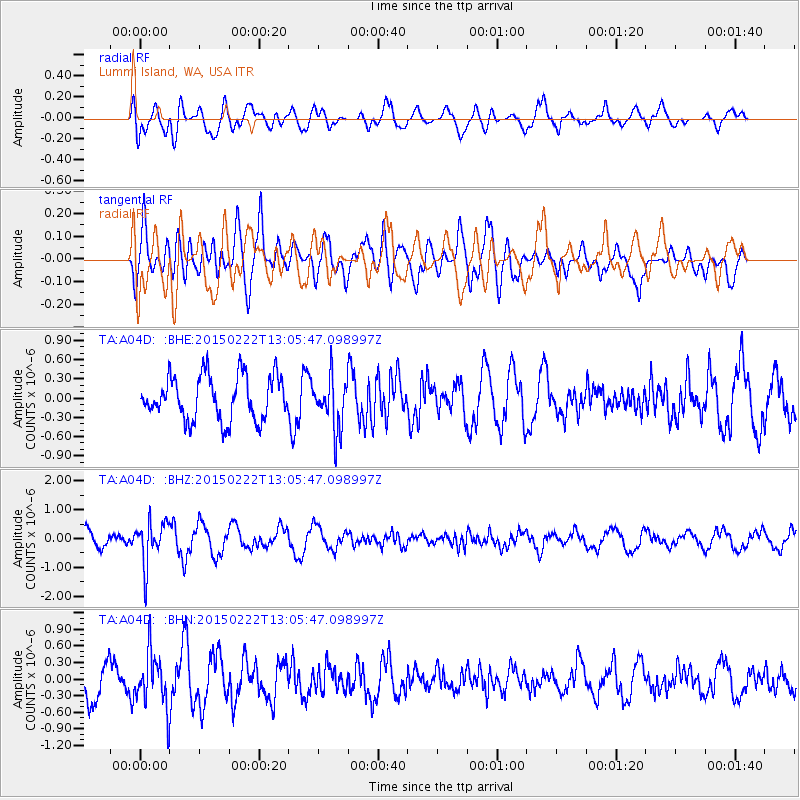
A04D Lummi Island, WA, USA - Earthquake Result Viewer
*The percent match for this event was below the threshold and hence no stack was calculated.
| Earthquake location: |
Colombia |
| Earthquake latitude/longitude: |
2.7/-76.5 |
| Earthquake time(UTC): |
2015/02/22 (053) 12:56:24 GMT |
| Earthquake Depth: |
151 km |
| Earthquake Magnitude: |
5.6 MB |
| Earthquake Catalog/Contributor: |
NEIC PDE/NEIC COMCAT |
|
| Network: |
TA USArray Transportable Network (new EarthScope stations) |
| Station: |
A04D Lummi Island, WA, USA |
| Lat/Lon: |
48.72 N/122.71 W |
| Elevation: |
13 m |
|
| Distance: |
60.5 deg |
| Az: |
326.682 deg |
| Baz: |
124.05 deg |
| Ray Param: |
$rayparam |
*The percent match for this event was below the threshold and hence was not used in the summary stack. |
|
| Radial Match: |
51.8466 % |
| Radial Bump: |
400 |
| Transverse Match: |
73.11725 % |
| Transverse Bump: |
400 |
| SOD ConfigId: |
7019011 |
| Insert Time: |
2019-04-17 00:36:00.907 +0000 |
| GWidth: |
2.5 |
| Max Bumps: |
400 |
| Tol: |
0.001 |
|
Signal To Noise
| Channel | StoN | STA | LTA |
| TA:A04D: :BHZ:20150222T13:05:47.098997Z | 2.7558935 | 7.428022E-7 | 2.6953225E-7 |
| TA:A04D: :BHN:20150222T13:05:47.098997Z | 1.5119474 | 4.935039E-7 | 3.2640278E-7 |
| TA:A04D: :BHE:20150222T13:05:47.098997Z | 1.3039656 | 4.6833173E-7 | 3.5915957E-7 |
| Arrivals |
| Ps | |
| PpPs | |
| PsPs/PpSs | |


