You are here: Home > Network List > TA - USArray Transportable Network (new EarthScope stations) Stations List
> Station O48A Farmland, IN, USA > Earthquake Result Viewer
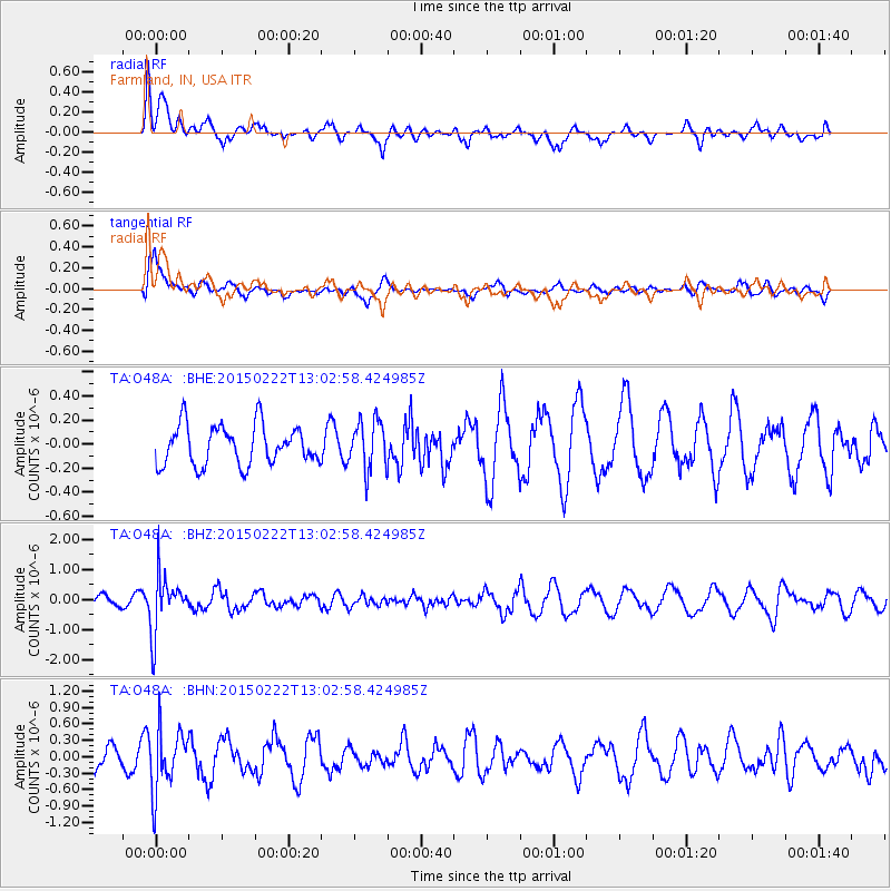
O48A Farmland, IN, USA - Earthquake Result Viewer
*The percent match for this event was below the threshold and hence no stack was calculated.
| Earthquake location: |
Colombia |
| Earthquake latitude/longitude: |
2.7/-76.5 |
| Earthquake time(UTC): |
2015/02/22 (053) 12:56:24 GMT |
| Earthquake Depth: |
151 km |
| Earthquake Magnitude: |
5.6 MB |
| Earthquake Catalog/Contributor: |
NEIC PDE/NEIC COMCAT |
|
| Network: |
TA USArray Transportable Network (new EarthScope stations) |
| Station: |
O48A Farmland, IN, USA |
| Lat/Lon: |
40.26 N/85.16 W |
| Elevation: |
300 m |
|
| Distance: |
38.2 deg |
| Az: |
349.267 deg |
| Baz: |
165.931 deg |
| Ray Param: |
$rayparam |
*The percent match for this event was below the threshold and hence was not used in the summary stack. |
|
| Radial Match: |
66.77756 % |
| Radial Bump: |
400 |
| Transverse Match: |
69.05832 % |
| Transverse Bump: |
400 |
| SOD ConfigId: |
7019011 |
| Insert Time: |
2019-04-17 00:36:55.696 +0000 |
| GWidth: |
2.5 |
| Max Bumps: |
400 |
| Tol: |
0.001 |
|
Signal To Noise
| Channel | StoN | STA | LTA |
| TA:O48A: :BHZ:20150222T13:02:58.424985Z | 4.2094216 | 9.5291693E-7 | 2.2637715E-7 |
| TA:O48A: :BHN:20150222T13:02:58.424985Z | 3.3728952 | 5.6269744E-7 | 1.6682921E-7 |
| TA:O48A: :BHE:20150222T13:02:58.424985Z | 1.2707322 | 2.0395797E-7 | 1.605043E-7 |
| Arrivals |
| Ps | |
| PpPs | |
| PsPs/PpSs | |


