You are here: Home > Network List > TA - USArray Transportable Network (new EarthScope stations) Stations List
> Station T56A Rocky Mt, VA, USA > Earthquake Result Viewer
T56A Rocky Mt, VA, USA - Earthquake Result Viewer
*The percent match for this event was below the threshold and hence no stack was calculated.
| Earthquake location: |
Colombia |
| Earthquake latitude/longitude: |
2.7/-76.5 |
| Earthquake time(UTC): |
2015/02/22 (053) 12:56:24 GMT |
| Earthquake Depth: |
151 km |
| Earthquake Magnitude: |
5.6 MB |
| Earthquake Catalog/Contributor: |
NEIC PDE/NEIC COMCAT |
|
| Network: |
TA USArray Transportable Network (new EarthScope stations) |
| Station: |
T56A Rocky Mt, VA, USA |
| Lat/Lon: |
37.03 N/80.03 W |
| Elevation: |
387 m |
|
| Distance: |
34.3 deg |
| Az: |
354.98 deg |
| Baz: |
173.729 deg |
| Ray Param: |
$rayparam |
*The percent match for this event was below the threshold and hence was not used in the summary stack. |
|
| Radial Match: |
58.664555 % |
| Radial Bump: |
400 |
| Transverse Match: |
62.581276 % |
| Transverse Bump: |
400 |
| SOD ConfigId: |
7019011 |
| Insert Time: |
2019-04-17 00:37:17.297 +0000 |
| GWidth: |
2.5 |
| Max Bumps: |
400 |
| Tol: |
0.001 |
|
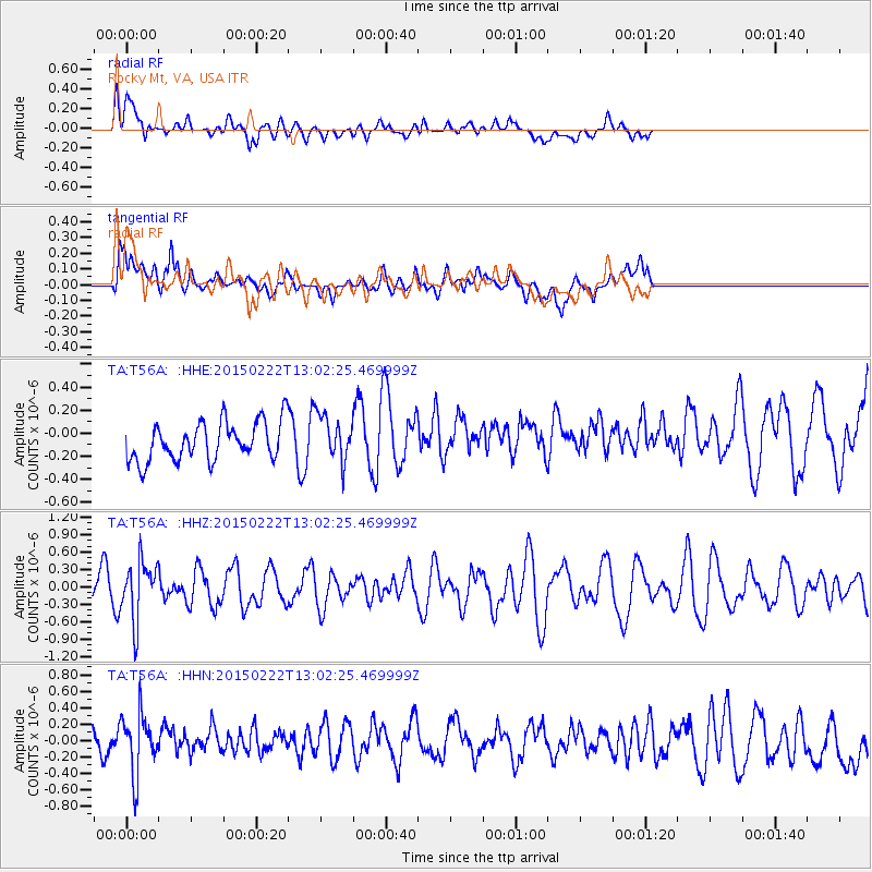
Signal To Noise
| Channel | StoN | STA | LTA |
| TA:T56A: :HHZ:20150222T13:02:25.469999Z | 1.738568 | 5.098491E-7 | 2.9325807E-7 |
| TA:T56A: :HHN:20150222T13:02:25.469999Z | 1.5506529 | 3.803188E-7 | 2.4526366E-7 |
| TA:T56A: :HHE:20150222T13:02:25.469999Z | 1.346285 | 2.3037956E-7 | 1.7112242E-7 |
| Arrivals |
| Ps | |
| PpPs | |
| PsPs/PpSs | |


