You are here: Home > Network List > UW - Pacific Northwest Regional Seismic Network Stations List
> Station LEBA Lebam, WA, USA > Earthquake Result Viewer
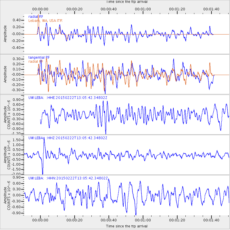
LEBA Lebam, WA, USA - Earthquake Result Viewer
*The percent match for this event was below the threshold and hence no stack was calculated.
| Earthquake location: |
Colombia |
| Earthquake latitude/longitude: |
2.7/-76.5 |
| Earthquake time(UTC): |
2015/02/22 (053) 12:56:24 GMT |
| Earthquake Depth: |
151 km |
| Earthquake Magnitude: |
5.6 MB |
| Earthquake Catalog/Contributor: |
NEIC PDE/NEIC COMCAT |
|
| Network: |
UW Pacific Northwest Regional Seismic Network |
| Station: |
LEBA Lebam, WA, USA |
| Lat/Lon: |
46.55 N/123.56 W |
| Elevation: |
73 m |
|
| Distance: |
59.8 deg |
| Az: |
324.216 deg |
| Baz: |
122.191 deg |
| Ray Param: |
$rayparam |
*The percent match for this event was below the threshold and hence was not used in the summary stack. |
|
| Radial Match: |
51.587395 % |
| Radial Bump: |
400 |
| Transverse Match: |
54.50384 % |
| Transverse Bump: |
400 |
| SOD ConfigId: |
7019011 |
| Insert Time: |
2019-04-17 00:39:17.085 +0000 |
| GWidth: |
2.5 |
| Max Bumps: |
400 |
| Tol: |
0.001 |
|
Signal To Noise
| Channel | StoN | STA | LTA |
| UW:LEBA: :HHZ:20150222T13:05:42.34802Z | 3.3044486 | 8.3942723E-7 | 2.5402943E-7 |
| UW:LEBA: :HHN:20150222T13:05:42.34802Z | 0.9245087 | 2.019651E-7 | 2.1845668E-7 |
| UW:LEBA: :HHE:20150222T13:05:42.34802Z | 1.551861 | 4.1542782E-7 | 2.6769652E-7 |
| Arrivals |
| Ps | |
| PpPs | |
| PsPs/PpSs | |


