You are here: Home > Network List > TA - USArray Transportable Network (new EarthScope stations) Stations List
> Station I46A Reed City, MI, USA > Earthquake Result Viewer
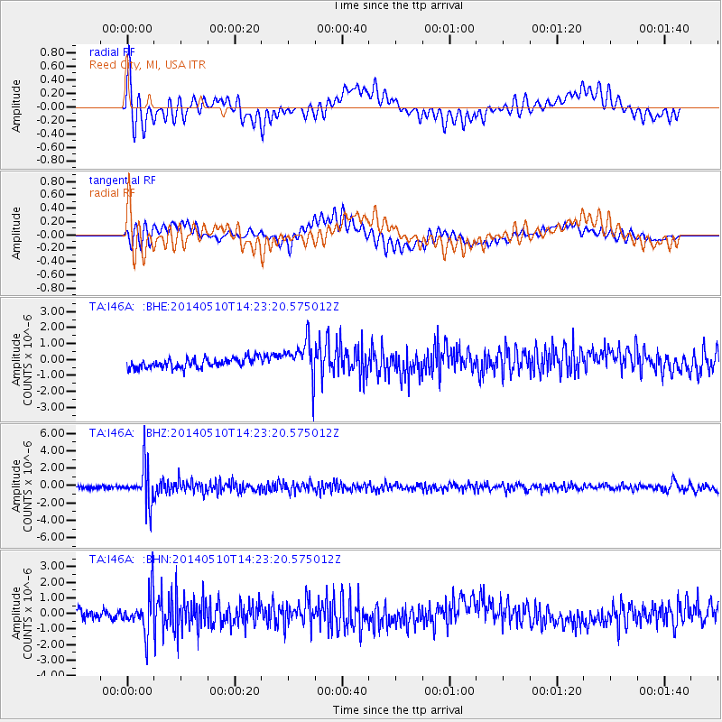
I46A Reed City, MI, USA - Earthquake Result Viewer
*The percent match for this event was below the threshold and hence no stack was calculated.
| Earthquake location: |
Southern Alaska |
| Earthquake latitude/longitude: |
60.0/-152.2 |
| Earthquake time(UTC): |
2014/05/10 (130) 14:16:08 GMT |
| Earthquake Depth: |
96 km |
| Earthquake Magnitude: |
5.8 ML, 5.5 MI, 5.7 MWP |
| Earthquake Catalog/Contributor: |
NEIC PDE/NEIC COMCAT |
|
| Network: |
TA USArray Transportable Network (new EarthScope stations) |
| Station: |
I46A Reed City, MI, USA |
| Lat/Lon: |
43.94 N/85.45 W |
| Elevation: |
359 m |
|
| Distance: |
42.2 deg |
| Az: |
81.386 deg |
| Baz: |
316.556 deg |
| Ray Param: |
$rayparam |
*The percent match for this event was below the threshold and hence was not used in the summary stack. |
|
| Radial Match: |
69.840034 % |
| Radial Bump: |
400 |
| Transverse Match: |
44.44003 % |
| Transverse Bump: |
400 |
| SOD ConfigId: |
626651 |
| Insert Time: |
2014-05-24 15:00:23.061 +0000 |
| GWidth: |
2.5 |
| Max Bumps: |
400 |
| Tol: |
0.001 |
|
Signal To Noise
| Channel | StoN | STA | LTA |
| TA:I46A: :BHZ:20140510T14:23:20.575012Z | 15.317771 | 2.1351918E-6 | 1.3939311E-7 |
| TA:I46A: :BHN:20140510T14:23:20.575012Z | 4.5376887 | 1.2722896E-6 | 2.8038275E-7 |
| TA:I46A: :BHE:20140510T14:23:20.575012Z | 4.045069 | 1.2025338E-6 | 2.9728386E-7 |
| Arrivals |
| Ps | |
| PpPs | |
| PsPs/PpSs | |


