You are here: Home > Network List > TA - USArray Transportable Network (new EarthScope stations) Stations List
> Station J61A Chester, VT, USA > Earthquake Result Viewer
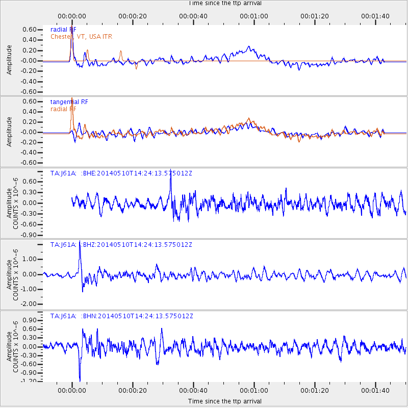
J61A Chester, VT, USA - Earthquake Result Viewer
*The percent match for this event was below the threshold and hence no stack was calculated.
| Earthquake location: |
Southern Alaska |
| Earthquake latitude/longitude: |
60.0/-152.2 |
| Earthquake time(UTC): |
2014/05/10 (130) 14:16:08 GMT |
| Earthquake Depth: |
96 km |
| Earthquake Magnitude: |
5.8 ML, 5.5 MI, 5.7 MWP |
| Earthquake Catalog/Contributor: |
NEIC PDE/NEIC COMCAT |
|
| Network: |
TA USArray Transportable Network (new EarthScope stations) |
| Station: |
J61A Chester, VT, USA |
| Lat/Lon: |
43.35 N/72.55 W |
| Elevation: |
253 m |
|
| Distance: |
48.9 deg |
| Az: |
72.237 deg |
| Baz: |
319.015 deg |
| Ray Param: |
$rayparam |
*The percent match for this event was below the threshold and hence was not used in the summary stack. |
|
| Radial Match: |
66.60849 % |
| Radial Bump: |
400 |
| Transverse Match: |
62.267033 % |
| Transverse Bump: |
400 |
| SOD ConfigId: |
626651 |
| Insert Time: |
2014-05-24 15:02:15.744 +0000 |
| GWidth: |
2.5 |
| Max Bumps: |
400 |
| Tol: |
0.001 |
|
Signal To Noise
| Channel | StoN | STA | LTA |
| TA:J61A: :BHZ:20140510T14:24:13.575012Z | 4.5311995 | 6.767296E-7 | 1.4934888E-7 |
| TA:J61A: :BHN:20140510T14:24:13.575012Z | 2.0310998 | 3.6825142E-7 | 1.8130642E-7 |
| TA:J61A: :BHE:20140510T14:24:13.575012Z | 2.2290897 | 2.789253E-7 | 1.251297E-7 |
| Arrivals |
| Ps | |
| PpPs | |
| PsPs/PpSs | |


