You are here: Home > Network List > TA - USArray Transportable Network (new EarthScope stations) Stations List
> Station N23A Red Feather Lakes, CO, USA > Earthquake Result Viewer
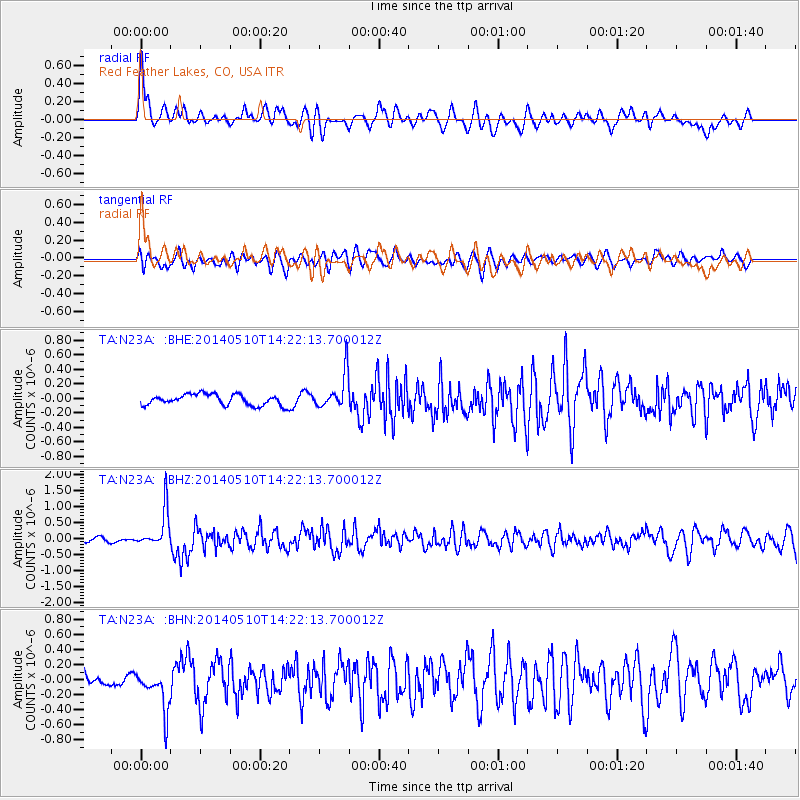
N23A Red Feather Lakes, CO, USA - Earthquake Result Viewer
*The percent match for this event was below the threshold and hence no stack was calculated.
| Earthquake location: |
Southern Alaska |
| Earthquake latitude/longitude: |
60.0/-152.2 |
| Earthquake time(UTC): |
2014/05/10 (130) 14:16:08 GMT |
| Earthquake Depth: |
96 km |
| Earthquake Magnitude: |
5.8 ML, 5.5 MI, 5.7 MWP |
| Earthquake Catalog/Contributor: |
NEIC PDE/NEIC COMCAT |
|
| Network: |
TA USArray Transportable Network (new EarthScope stations) |
| Station: |
N23A Red Feather Lakes, CO, USA |
| Lat/Lon: |
40.89 N/105.94 W |
| Elevation: |
2458 m |
|
| Distance: |
34.2 deg |
| Az: |
102.951 deg |
| Baz: |
319.768 deg |
| Ray Param: |
$rayparam |
*The percent match for this event was below the threshold and hence was not used in the summary stack. |
|
| Radial Match: |
72.52062 % |
| Radial Bump: |
400 |
| Transverse Match: |
56.701687 % |
| Transverse Bump: |
400 |
| SOD ConfigId: |
626651 |
| Insert Time: |
2014-05-24 15:06:28.643 +0000 |
| GWidth: |
2.5 |
| Max Bumps: |
400 |
| Tol: |
0.001 |
|
Signal To Noise
| Channel | StoN | STA | LTA |
| TA:N23A: :BHZ:20140510T14:22:13.700012Z | 7.4408197 | 5.89291E-7 | 7.919706E-8 |
| TA:N23A: :BHN:20140510T14:22:13.700012Z | 2.8596735 | 2.8875087E-7 | 1.0097337E-7 |
| TA:N23A: :BHE:20140510T14:22:13.700012Z | 3.2765388 | 2.4677095E-7 | 7.5314524E-8 |
| Arrivals |
| Ps | |
| PpPs | |
| PsPs/PpSs | |


