KURK Kurchatov, Kazakhstan - Earthquake Result Viewer
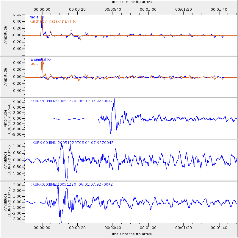
Earthquake location: W. Caroline Islands, Micronesia
Earthquake latitude/longitude: 12.2/141.0
Earthquake time(UTC): 2005/12/20 (354) 05:51:12 GMT
Earthquake Depth: 23 km
Earthquake Magnitude: 5.8 MB, 5.7 MS, 6.1 MW, 6.1 MW
Earthquake Catalog/Contributor: WHDF/NEIC
Network: II Global Seismograph Network (GSN - IRIS/IDA)
Station: KURK Kurchatov, Kazakhstan
Lat/Lon: 50.72 N/78.62 E
Elevation: 184 m
Distance: 63.2 deg
Az: 320.879 deg
Baz: 104.008 deg
Ray Param: 0.059693947
Estimated Moho Depth: 39.5 km
Estimated Crust Vp/Vs: 1.79
Assumed Crust Vp: 6.552 km/s
Estimated Crust Vs: 3.671 km/s
Estimated Crust Poisson's Ratio: 0.27
Radial Match: 98.27087 %
Radial Bump: 352
Transverse Match: 89.29377 %
Transverse Bump: 400
SOD ConfigId: 2422
Insert Time: 2010-03-01 22:04:11.567 +0000
GWidth: 2.5
Max Bumps: 400
Tol: 0.001

Signal To Noise

ChannelStoNSTALTA
II:KURK:00:BHN:20051220T06:01:07.927004Z1.00992759.81295E-89.7164886E-8
II:KURK:00:BHE:20051220T06:01:07.927004Z4.2255033.6291388E-78.5886555E-8
II:KURK:00:BHZ:20051220T06:01:07.927004Z6.35253868.08173E-71.2722047E-7
Arrivals
Ps5.0 SECOND
PpPs16 SECOND
PsPs/PpSs21 SECOND