You are here: Home > Network List > TA - USArray Transportable Network (new EarthScope stations) Stations List
> Station W59A Clinton, NC, USA > Earthquake Result Viewer
W59A Clinton, NC, USA - Earthquake Result Viewer
*The percent match for this event was below the threshold and hence no stack was calculated.
| Earthquake location: |
Southern Alaska |
| Earthquake latitude/longitude: |
60.0/-152.2 |
| Earthquake time(UTC): |
2014/05/10 (130) 14:16:08 GMT |
| Earthquake Depth: |
96 km |
| Earthquake Magnitude: |
5.8 ML, 5.5 MI, 5.7 MWP |
| Earthquake Catalog/Contributor: |
NEIC PDE/NEIC COMCAT |
|
| Network: |
TA USArray Transportable Network (new EarthScope stations) |
| Station: |
W59A Clinton, NC, USA |
| Lat/Lon: |
35.17 N/78.44 W |
| Elevation: |
60 m |
|
| Distance: |
52.3 deg |
| Az: |
83.508 deg |
| Baz: |
322.461 deg |
| Ray Param: |
$rayparam |
*The percent match for this event was below the threshold and hence was not used in the summary stack. |
|
| Radial Match: |
72.63166 % |
| Radial Bump: |
400 |
| Transverse Match: |
53.82126 % |
| Transverse Bump: |
400 |
| SOD ConfigId: |
626651 |
| Insert Time: |
2014-05-24 15:14:24.198 +0000 |
| GWidth: |
2.5 |
| Max Bumps: |
400 |
| Tol: |
0.001 |
|
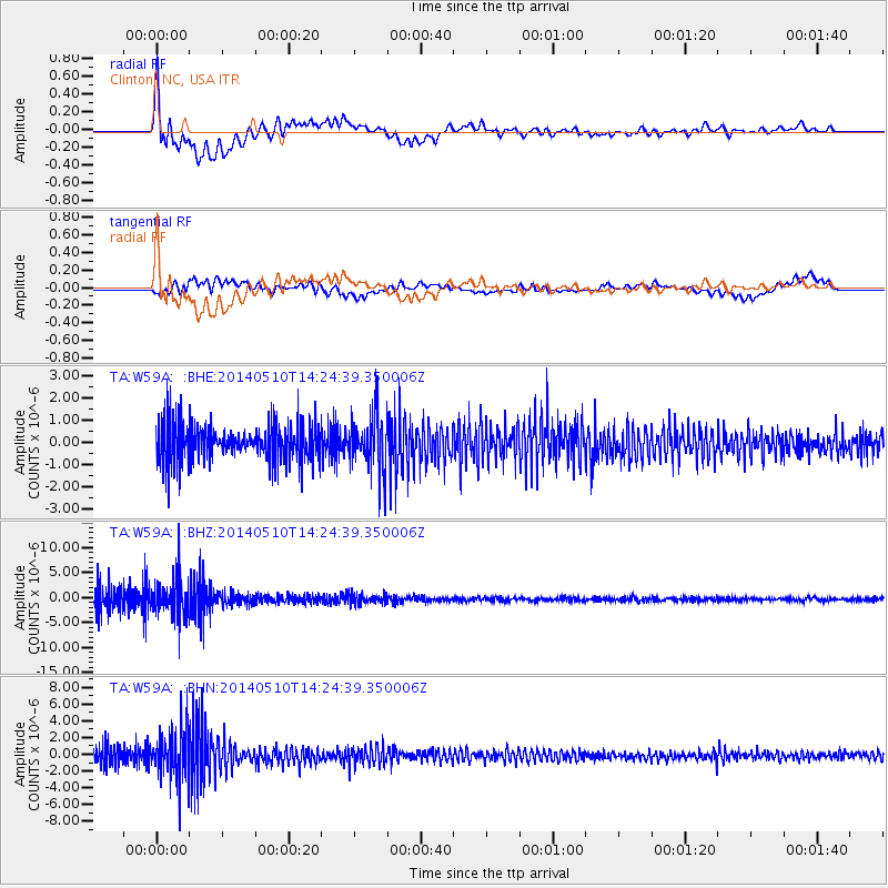
Signal To Noise
| Channel | StoN | STA | LTA |
| TA:W59A: :BHZ:20140510T14:24:39.350006Z | 2.1165874 | 3.6893393E-6 | 1.7430602E-6 |
| TA:W59A: :BHN:20140510T14:24:39.350006Z | 3.5677898 | 2.9075213E-6 | 8.149363E-7 |
| TA:W59A: :BHE:20140510T14:24:39.350006Z | 1.4327582 | 1.2308464E-6 | 8.5907465E-7 |
| Arrivals |
| Ps | |
| PpPs | |
| PsPs/PpSs | |


