You are here: Home > Network List > TA - USArray Transportable Network (new EarthScope stations) Stations List
> Station O03E Paynes Creek, CA, USA > Earthquake Result Viewer
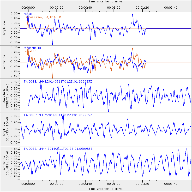
O03E Paynes Creek, CA, USA - Earthquake Result Viewer
*The percent match for this event was below the threshold and hence no stack was calculated.
| Earthquake location: |
Bismarck Sea |
| Earthquake latitude/longitude: |
-3.5/146.1 |
| Earthquake time(UTC): |
2014/05/11 (131) 01:10:18 GMT |
| Earthquake Depth: |
22 km |
| Earthquake Magnitude: |
5.6 MWP |
| Earthquake Catalog/Contributor: |
NEIC PDE/NEIC COMCAT |
|
| Network: |
TA USArray Transportable Network (new EarthScope stations) |
| Station: |
O03E Paynes Creek, CA, USA |
| Lat/Lon: |
40.29 N/121.80 W |
| Elevation: |
967 m |
|
| Distance: |
93.8 deg |
| Az: |
50.002 deg |
| Baz: |
268.724 deg |
| Ray Param: |
$rayparam |
*The percent match for this event was below the threshold and hence was not used in the summary stack. |
|
| Radial Match: |
73.62589 % |
| Radial Bump: |
400 |
| Transverse Match: |
41.57868 % |
| Transverse Bump: |
400 |
| SOD ConfigId: |
626651 |
| Insert Time: |
2014-05-25 01:38:07.387 +0000 |
| GWidth: |
2.5 |
| Max Bumps: |
400 |
| Tol: |
0.001 |
|
Signal To Noise
| Channel | StoN | STA | LTA |
| TA:O03E: :HHZ:20140511T01:23:01.969985Z | 0.80102164 | 8.198184E-8 | 1.0234659E-7 |
| TA:O03E: :HHN:20140511T01:23:01.969985Z | 1.4429079 | 1.8920097E-7 | 1.3112478E-7 |
| TA:O03E: :HHE:20140511T01:23:01.969985Z | 0.87768006 | 1.3214452E-7 | 1.5056116E-7 |
| Arrivals |
| Ps | |
| PpPs | |
| PsPs/PpSs | |


