KURK Kurchatov, Kazakhstan - Earthquake Result Viewer
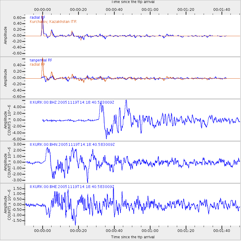
Earthquake location: Northern Sumatra, Indonesia
Earthquake latitude/longitude: 2.2/96.8
Earthquake time(UTC): 2005/11/19 (323) 14:10:13 GMT
Earthquake Depth: 21 km
Earthquake Magnitude: 6.0 MB, 6.1 MS, 6.5 MW, 6.5 MW
Earthquake Catalog/Contributor: WHDF/NEIC
Network: II Global Seismograph Network (GSN - IRIS/IDA)
Station: KURK Kurchatov, Kazakhstan
Lat/Lon: 50.72 N/78.62 E
Elevation: 184 m
Distance: 50.8 deg
Az: 345.173 deg
Baz: 156.281 deg
Ray Param: 0.06781012
Estimated Moho Depth: 42.0 km
Estimated Crust Vp/Vs: 1.77
Assumed Crust Vp: 6.552 km/s
Estimated Crust Vs: 3.702 km/s
Estimated Crust Poisson's Ratio: 0.27
Radial Match: 97.975655 %
Radial Bump: 305
Transverse Match: 92.13711 %
Transverse Bump: 400
SOD ConfigId: 2448
Insert Time: 2010-03-01 22:05:51.781 +0000
GWidth: 2.5
Max Bumps: 400
Tol: 0.001

Signal To Noise

ChannelStoNSTALTA
II:KURK:00:BHN:20051119T14:18:40.583009Z13.8765361.3732895E-69.896486E-8
II:KURK:00:BHE:20051119T14:18:40.583009Z7.47470475.0751026E-76.789703E-8
II:KURK:00:BHZ:20051119T14:18:40.583009Z22.3965442.7438732E-61.2251324E-7
Arrivals
Ps5.2 SECOND
PpPs17 SECOND
PsPs/PpSs22 SECOND