KURK Kurchatov, Kazakhstan - Earthquake Result Viewer
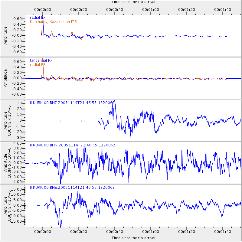
Earthquake location: Off East Coast Of Honshu, Japan
Earthquake latitude/longitude: 38.1/144.9
Earthquake time(UTC): 2005/11/14 (318) 21:38:51 GMT
Earthquake Depth: 11 km
Earthquake Magnitude: 6.7 MB, 6.8 MS, 7.0 MW, 6.9 MW
Earthquake Catalog/Contributor: WHDF/NEIC
Network: II Global Seismograph Network (GSN - IRIS/IDA)
Station: KURK Kurchatov, Kazakhstan
Lat/Lon: 50.72 N/78.62 E
Elevation: 184 m
Distance: 47.5 deg
Az: 307.819 deg
Baz: 78.595 deg
Ray Param: 0.06997557
Estimated Moho Depth: 42.25 km
Estimated Crust Vp/Vs: 1.70
Assumed Crust Vp: 6.552 km/s
Estimated Crust Vs: 3.854 km/s
Estimated Crust Poisson's Ratio: 0.24
Radial Match: 97.72011 %
Radial Bump: 272
Transverse Match: 89.81951 %
Transverse Bump: 400
SOD ConfigId: 2448
Insert Time: 2010-03-01 22:05:57.774 +0000
GWidth: 2.5
Max Bumps: 400
Tol: 0.001

Signal To Noise

ChannelStoNSTALTA
II:KURK:00:BHN:20051114T21:46:55.132006Z4.09878354.1894862E-71.0221292E-7
II:KURK:00:BHE:20051114T21:46:55.132006Z26.1878852.4731974E-69.444051E-8
II:KURK:00:BHZ:20051114T21:46:55.132006Z25.4347154.8048882E-61.8891065E-7
Arrivals
Ps4.8 SECOND
PpPs16 SECOND
PsPs/PpSs21 SECOND