KURK Kurchatov, Kazakhstan - Earthquake Result Viewer
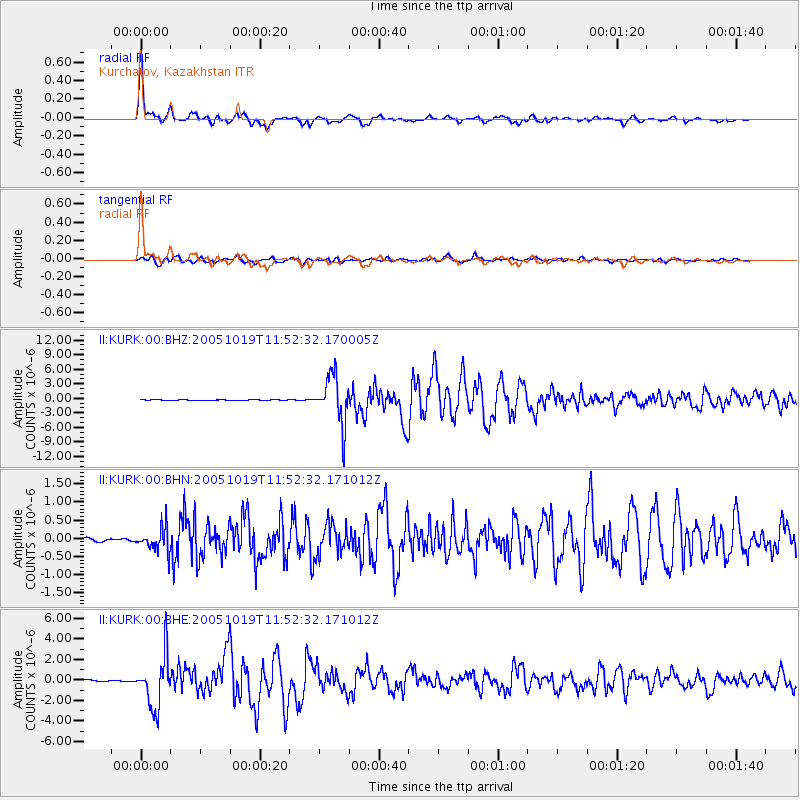
Earthquake location: Near East Coast Of Honshu, Japan
Earthquake latitude/longitude: 36.4/140.8
Earthquake time(UTC): 2005/10/19 (292) 11:44:42 GMT
Earthquake Depth: 32 km
Earthquake Magnitude: 6.2 MB, 6.5 MS, 6.4 MW, 6.3 MW
Earthquake Catalog/Contributor: WHDF/NEIC
Network: II Global Seismograph Network (GSN - IRIS/IDA)
Station: KURK Kurchatov, Kazakhstan
Lat/Lon: 50.72 N/78.62 E
Elevation: 184 m
Distance: 46.0 deg
Az: 308.516 deg
Baz: 83.177 deg
Ray Param: 0.07088086
Estimated Moho Depth: 41.5 km
Estimated Crust Vp/Vs: 1.74
Assumed Crust Vp: 6.552 km/s
Estimated Crust Vs: 3.766 km/s
Estimated Crust Poisson's Ratio: 0.25
Radial Match: 98.153625 %
Radial Bump: 376
Transverse Match: 93.397385 %
Transverse Bump: 400
SOD ConfigId: 2475
Insert Time: 2010-03-01 22:06:25.034 +0000
GWidth: 2.5
Max Bumps: 400
Tol: 0.001

Signal To Noise

ChannelStoNSTALTA
II:KURK:00:BHN:20051019T11:52:32.171012Z6.33277033.240244E-75.1166293E-8
II:KURK:00:BHE:20051019T11:52:32.171012Z37.9911652.5198485E-66.6327225E-8
II:KURK:00:BHZ:20051019T11:52:32.170005Z137.260574.909916E-63.5770764E-8
Arrivals
Ps5.0 SECOND
PpPs16 SECOND
PsPs/PpSs21 SECOND