You are here: Home > Network List > TA - USArray Transportable Network (new EarthScope stations) Stations List
> Station J01E Myrtle Point, OR, USA > Earthquake Result Viewer
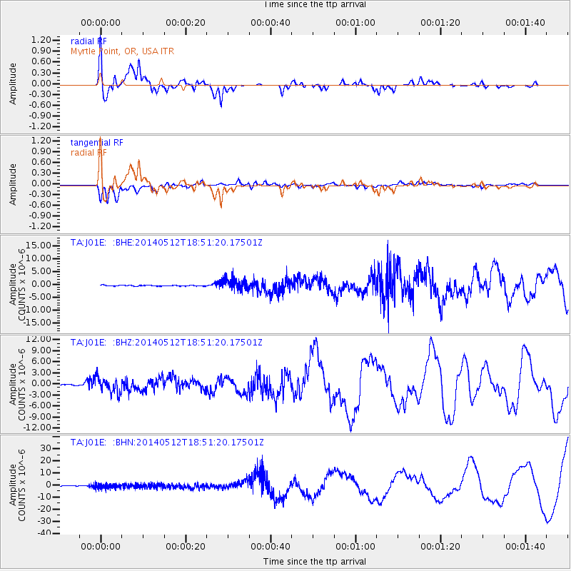
J01E Myrtle Point, OR, USA - Earthquake Result Viewer
*The percent match for this event was below the threshold and hence no stack was calculated.
| Earthquake location: |
Southern East Pacific Rise |
| Earthquake latitude/longitude: |
-50.0/-114.7 |
| Earthquake time(UTC): |
2014/05/12 (132) 18:38:37 GMT |
| Earthquake Depth: |
8.2 km |
| Earthquake Magnitude: |
5.8 MB |
| Earthquake Catalog/Contributor: |
NEIC PDE/NEIC COMCAT |
|
| Network: |
TA USArray Transportable Network (new EarthScope stations) |
| Station: |
J01E Myrtle Point, OR, USA |
| Lat/Lon: |
43.16 N/123.93 W |
| Elevation: |
128 m |
|
| Distance: |
93.1 deg |
| Az: |
353.227 deg |
| Baz: |
174.026 deg |
| Ray Param: |
$rayparam |
*The percent match for this event was below the threshold and hence was not used in the summary stack. |
|
| Radial Match: |
67.17316 % |
| Radial Bump: |
382 |
| Transverse Match: |
52.698494 % |
| Transverse Bump: |
400 |
| SOD ConfigId: |
626651 |
| Insert Time: |
2014-05-26 19:15:17.188 +0000 |
| GWidth: |
2.5 |
| Max Bumps: |
400 |
| Tol: |
0.001 |
|
Signal To Noise
| Channel | StoN | STA | LTA |
| TA:J01E: :BHZ:20140512T18:51:20.17501Z | 15.054952 | 2.048439E-6 | 1.3606414E-7 |
| TA:J01E: :BHN:20140512T18:51:20.17501Z | 17.556782 | 1.858114E-6 | 1.05834545E-7 |
| TA:J01E: :BHE:20140512T18:51:20.17501Z | 14.059088 | 2.2766349E-6 | 1.6193333E-7 |
| Arrivals |
| Ps | |
| PpPs | |
| PsPs/PpSs | |


