KURK Kurchatov, Kazakhstan - Earthquake Result Viewer
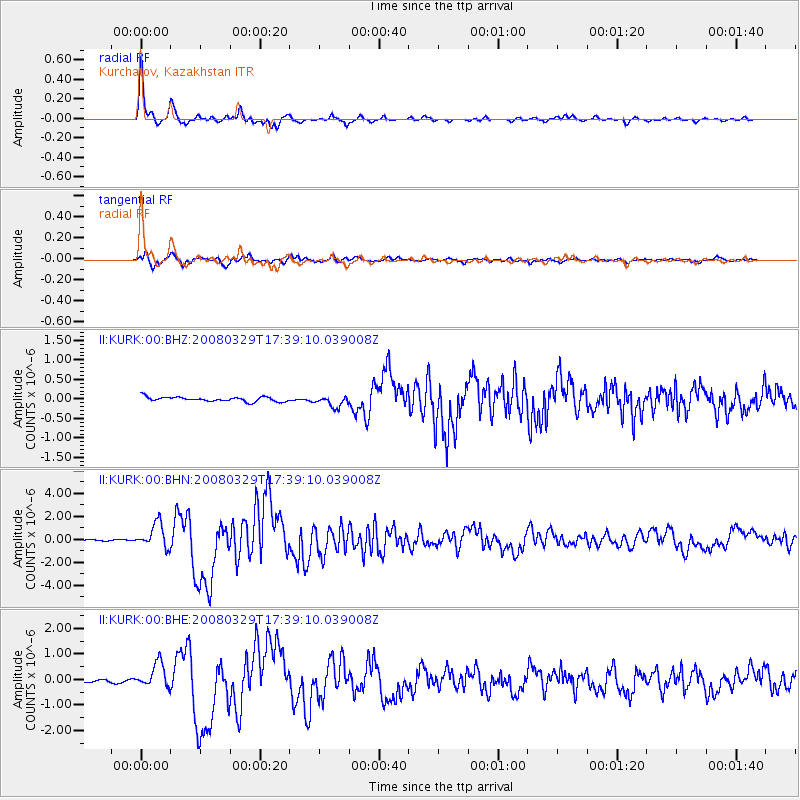
Earthquake location: Off W Coast Of Northern Sumatra
Earthquake latitude/longitude: 2.9/95.3
Earthquake time(UTC): 2008/03/29 (089) 17:30:50 GMT
Earthquake Depth: 20 km
Earthquake Magnitude: 5.8 MB, 6.5 MS, 6.3 MW, 6.3 MW
Earthquake Catalog/Contributor: WHDF/NEIC
Network: II Global Seismograph Network (GSN - IRIS/IDA)
Station: KURK Kurchatov, Kazakhstan
Lat/Lon: 50.72 N/78.62 E
Elevation: 184 m
Distance: 49.7 deg
Az: 346.167 deg
Baz: 157.936 deg
Ray Param: 0.06849171
Estimated Moho Depth: 42.25 km
Estimated Crust Vp/Vs: 1.76
Assumed Crust Vp: 6.552 km/s
Estimated Crust Vs: 3.718 km/s
Estimated Crust Poisson's Ratio: 0.26
Radial Match: 97.79225 %
Radial Bump: 275
Transverse Match: 92.25373 %
Transverse Bump: 400
SOD ConfigId: 2504
Insert Time: 2010-03-01 22:06:55.446 +0000
GWidth: 2.5
Max Bumps: 400
Tol: 0.001

Signal To Noise

ChannelStoNSTALTA
II:KURK:00:BHN:20080329T17:39:10.039008Z22.7931841.0630176E-64.6637528E-8
II:KURK:00:BHE:20080329T17:39:10.039008Z5.9326034.7808E-78.0585195E-8
II:KURK:00:BHZ:20080329T17:39:10.039008Z2.51759151.4462775E-75.7446865E-8
Arrivals
Ps5.2 SECOND
PpPs17 SECOND
PsPs/PpSs22 SECOND