You are here: Home > Network List > TA - USArray Transportable Network (new EarthScope stations) Stations List
> Station M54A Oil Creek State Park, Oil City, PA, USA > Earthquake Result Viewer
M54A Oil Creek State Park, Oil City, PA, USA - Earthquake Result Viewer

| Earthquake location: |
Off Coast Of Jalisco, Mexico |
| Earthquake latitude/longitude: |
18.7/-106.8 |
| Earthquake time(UTC): |
2015/02/22 (053) 14:23:14 GMT |
| Earthquake Depth: |
10 km |
| Earthquake Magnitude: |
6.2 MO |
| Earthquake Catalog/Contributor: |
NEIC PDE/NEIC ALERT |
|
| Network: |
TA USArray Transportable Network (new EarthScope stations) |
| Station: |
M54A Oil Creek State Park, Oil City, PA, USA |
| Lat/Lon: |
41.51 N/79.66 W |
| Elevation: |
488 m |
|
| Distance: |
32.4 deg |
| Az: |
39.71 deg |
| Baz: |
233.728 deg |
| Ray Param: |
0.07865479 |
| Estimated Moho Depth: |
65.5 km |
| Estimated Crust Vp/Vs: |
1.65 |
| Assumed Crust Vp: |
6.121 km/s |
| Estimated Crust Vs: |
3.709 km/s |
| Estimated Crust Poisson's Ratio: |
0.21 |
|
| Radial Match: |
90.68738 % |
| Radial Bump: |
176 |
| Transverse Match: |
63.51147 % |
| Transverse Bump: |
370 |
| SOD ConfigId: |
7019011 |
| Insert Time: |
2019-04-17 00:54:04.450 +0000 |
| GWidth: |
2.5 |
| Max Bumps: |
400 |
| Tol: |
0.001 |
|
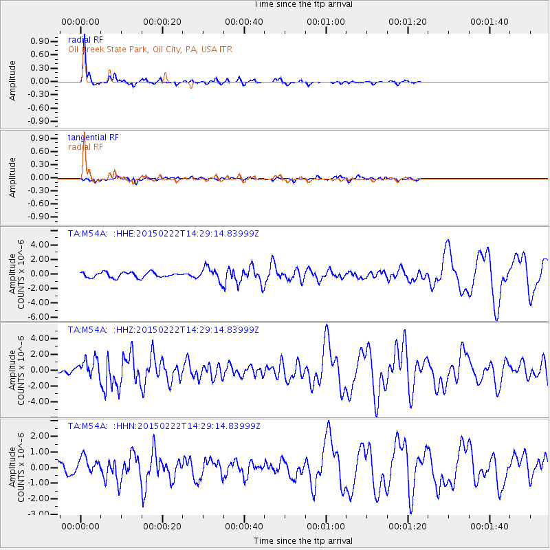
Signal To Noise
| Channel | StoN | STA | LTA |
| TA:M54A: :HHZ:20150222T14:29:14.83999Z | 2.5747201 | 1.1965944E-6 | 4.6474736E-7 |
| TA:M54A: :HHN:20150222T14:29:14.83999Z | 2.355407 | 5.439249E-7 | 2.3092608E-7 |
| TA:M54A: :HHE:20150222T14:29:14.83999Z | 2.189259 | 8.111596E-7 | 3.705179E-7 |
| Arrivals |
| Ps | 7.5 SECOND |
| PpPs | 26 SECOND |
| PsPs/PpSs | 34 SECOND |


