You are here: Home > Network List > TA - USArray Transportable Network (new EarthScope stations) Stations List
> Station Q61A Milford, DE, USA > Earthquake Result Viewer
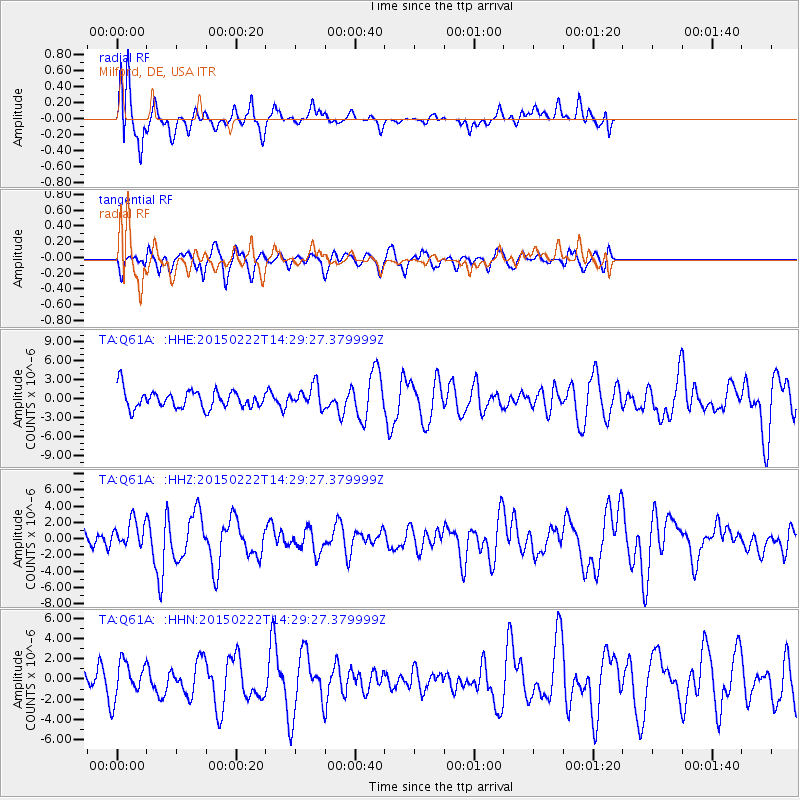
Q61A Milford, DE, USA - Earthquake Result Viewer
*The percent match for this event was below the threshold and hence no stack was calculated.
| Earthquake location: |
Off Coast Of Jalisco, Mexico |
| Earthquake latitude/longitude: |
18.7/-106.8 |
| Earthquake time(UTC): |
2015/02/22 (053) 14:23:14 GMT |
| Earthquake Depth: |
10 km |
| Earthquake Magnitude: |
6.2 MO |
| Earthquake Catalog/Contributor: |
NEIC PDE/NEIC ALERT |
|
| Network: |
TA USArray Transportable Network (new EarthScope stations) |
| Station: |
Q61A Milford, DE, USA |
| Lat/Lon: |
38.88 N/75.33 W |
| Elevation: |
5.0 m |
|
| Distance: |
33.9 deg |
| Az: |
46.994 deg |
| Baz: |
242.621 deg |
| Ray Param: |
$rayparam |
*The percent match for this event was below the threshold and hence was not used in the summary stack. |
|
| Radial Match: |
62.38707 % |
| Radial Bump: |
400 |
| Transverse Match: |
64.30849 % |
| Transverse Bump: |
400 |
| SOD ConfigId: |
7019011 |
| Insert Time: |
2019-04-17 00:54:31.130 +0000 |
| GWidth: |
2.5 |
| Max Bumps: |
400 |
| Tol: |
0.001 |
|
Signal To Noise
| Channel | StoN | STA | LTA |
| TA:Q61A: :HHZ:20150222T14:29:27.379999Z | 1.4901252 | 1.6770985E-6 | 1.1254748E-6 |
| TA:Q61A: :HHN:20150222T14:29:27.379999Z | 1.302247 | 1.8008096E-6 | 1.3828479E-6 |
| TA:Q61A: :HHE:20150222T14:29:27.379999Z | 1.136722 | 1.6344985E-6 | 1.4379053E-6 |
| Arrivals |
| Ps | |
| PpPs | |
| PsPs/PpSs | |


