You are here: Home > Network List > TA - USArray Transportable Network (new EarthScope stations) Stations List
> Station J01E Myrtle Point, OR, USA > Earthquake Result Viewer
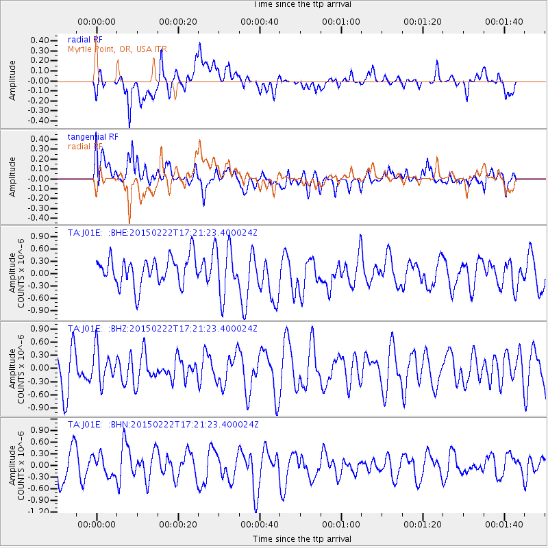
J01E Myrtle Point, OR, USA - Earthquake Result Viewer
*The percent match for this event was below the threshold and hence no stack was calculated.
| Earthquake location: |
Northern Mid-Atlantic Ridge |
| Earthquake latitude/longitude: |
20.0/-45.8 |
| Earthquake time(UTC): |
2015/02/22 (053) 17:10:54 GMT |
| Earthquake Depth: |
10 km |
| Earthquake Magnitude: |
5.0 MW |
| Earthquake Catalog/Contributor: |
ISC/ISC |
|
| Network: |
TA USArray Transportable Network (new EarthScope stations) |
| Station: |
J01E Myrtle Point, OR, USA |
| Lat/Lon: |
43.16 N/123.93 W |
| Elevation: |
128 m |
|
| Distance: |
68.1 deg |
| Az: |
309.479 deg |
| Baz: |
82.731 deg |
| Ray Param: |
$rayparam |
*The percent match for this event was below the threshold and hence was not used in the summary stack. |
|
| Radial Match: |
49.68574 % |
| Radial Bump: |
400 |
| Transverse Match: |
47.30051 % |
| Transverse Bump: |
400 |
| SOD ConfigId: |
7019011 |
| Insert Time: |
2019-04-17 01:03:27.169 +0000 |
| GWidth: |
2.5 |
| Max Bumps: |
400 |
| Tol: |
0.001 |
|
Signal To Noise
| Channel | StoN | STA | LTA |
| TA:J01E: :BHZ:20150222T17:21:23.400024Z | 1.0720339 | 3.8672712E-7 | 3.6074152E-7 |
| TA:J01E: :BHN:20150222T17:21:23.400024Z | 0.6841879 | 2.6436007E-7 | 3.8638518E-7 |
| TA:J01E: :BHE:20150222T17:21:23.400024Z | 1.7650925 | 5.965586E-7 | 3.3797582E-7 |
| Arrivals |
| Ps | |
| PpPs | |
| PsPs/PpSs | |


