You are here: Home > Network List > TA - USArray Transportable Network (new EarthScope stations) Stations List
> Station O03E Paynes Creek, CA, USA > Earthquake Result Viewer
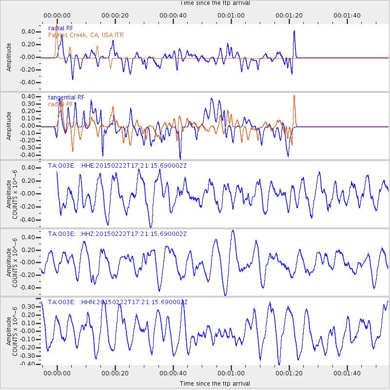
O03E Paynes Creek, CA, USA - Earthquake Result Viewer
*The percent match for this event was below the threshold and hence no stack was calculated.
| Earthquake location: |
Northern Mid-Atlantic Ridge |
| Earthquake latitude/longitude: |
20.0/-45.8 |
| Earthquake time(UTC): |
2015/02/22 (053) 17:10:54 GMT |
| Earthquake Depth: |
10 km |
| Earthquake Magnitude: |
5.0 MW |
| Earthquake Catalog/Contributor: |
ISC/ISC |
|
| Network: |
TA USArray Transportable Network (new EarthScope stations) |
| Station: |
O03E Paynes Creek, CA, USA |
| Lat/Lon: |
40.29 N/121.80 W |
| Elevation: |
967 m |
|
| Distance: |
66.9 deg |
| Az: |
306.187 deg |
| Baz: |
82.883 deg |
| Ray Param: |
$rayparam |
*The percent match for this event was below the threshold and hence was not used in the summary stack. |
|
| Radial Match: |
54.83312 % |
| Radial Bump: |
400 |
| Transverse Match: |
58.616096 % |
| Transverse Bump: |
400 |
| SOD ConfigId: |
7019011 |
| Insert Time: |
2019-04-17 01:03:42.198 +0000 |
| GWidth: |
2.5 |
| Max Bumps: |
400 |
| Tol: |
0.001 |
|
Signal To Noise
| Channel | StoN | STA | LTA |
| TA:O03E: :HHZ:20150222T17:21:15.690002Z | 0.6201584 | 1.0792934E-7 | 1.7403512E-7 |
| TA:O03E: :HHN:20150222T17:21:15.690002Z | 0.72741157 | 2.0590025E-7 | 2.8305882E-7 |
| TA:O03E: :HHE:20150222T17:21:15.690002Z | 1.3690042 | 2.7247847E-7 | 1.9903406E-7 |
| Arrivals |
| Ps | |
| PpPs | |
| PsPs/PpSs | |


