You are here: Home > Network List > TA - USArray Transportable Network (new EarthScope stations) Stations List
> Station T25A Trinidad, CO, USA > Earthquake Result Viewer
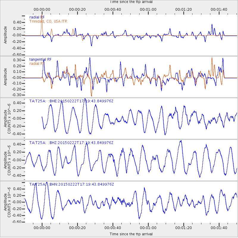
T25A Trinidad, CO, USA - Earthquake Result Viewer
*The percent match for this event was below the threshold and hence no stack was calculated.
| Earthquake location: |
Northern Mid-Atlantic Ridge |
| Earthquake latitude/longitude: |
20.0/-45.8 |
| Earthquake time(UTC): |
2015/02/22 (053) 17:10:54 GMT |
| Earthquake Depth: |
10 km |
| Earthquake Magnitude: |
5.0 MW |
| Earthquake Catalog/Contributor: |
ISC/ISC |
|
| Network: |
TA USArray Transportable Network (new EarthScope stations) |
| Station: |
T25A Trinidad, CO, USA |
| Lat/Lon: |
37.14 N/104.41 W |
| Elevation: |
2017 m |
|
| Distance: |
53.4 deg |
| Az: |
301.847 deg |
| Baz: |
91.596 deg |
| Ray Param: |
$rayparam |
*The percent match for this event was below the threshold and hence was not used in the summary stack. |
|
| Radial Match: |
36.427513 % |
| Radial Bump: |
356 |
| Transverse Match: |
37.17873 % |
| Transverse Bump: |
400 |
| SOD ConfigId: |
7019011 |
| Insert Time: |
2019-04-17 01:03:50.350 +0000 |
| GWidth: |
2.5 |
| Max Bumps: |
400 |
| Tol: |
0.001 |
|
Signal To Noise
| Channel | StoN | STA | LTA |
| TA:T25A: :BHZ:20150222T17:19:43.849976Z | 1.8881962 | 1.899849E-7 | 1.0061714E-7 |
| TA:T25A: :BHN:20150222T17:19:43.849976Z | 2.1035364 | 3.9345767E-7 | 1.8704581E-7 |
| TA:T25A: :BHE:20150222T17:19:43.849976Z | 0.8236321 | 2.1508237E-7 | 2.611389E-7 |
| Arrivals |
| Ps | |
| PpPs | |
| PsPs/PpSs | |


