You are here: Home > Network List > WY - Yellowstone Wyoming Seismic Network Stations List
> Station YHH Holmes Hill, YNP, WY, USA > Earthquake Result Viewer
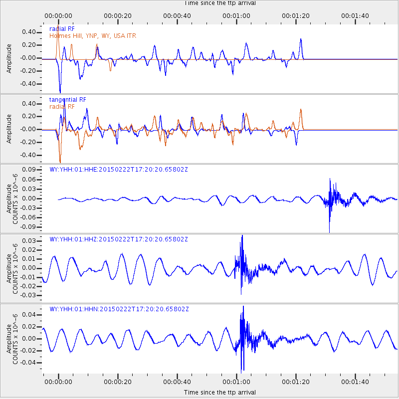
YHH Holmes Hill, YNP, WY, USA - Earthquake Result Viewer
*The percent match for this event was below the threshold and hence no stack was calculated.
| Earthquake location: |
Northern Mid-Atlantic Ridge |
| Earthquake latitude/longitude: |
20.0/-45.8 |
| Earthquake time(UTC): |
2015/02/22 (053) 17:10:54 GMT |
| Earthquake Depth: |
10 km |
| Earthquake Magnitude: |
5.0 MW |
| Earthquake Catalog/Contributor: |
ISC/ISC |
|
| Network: |
WY Yellowstone Wyoming Seismic Network |
| Station: |
YHH Holmes Hill, YNP, WY, USA |
| Lat/Lon: |
44.79 N/110.85 W |
| Elevation: |
2717 m |
|
| Distance: |
58.6 deg |
| Az: |
310.839 deg |
| Baz: |
92.416 deg |
| Ray Param: |
$rayparam |
*The percent match for this event was below the threshold and hence was not used in the summary stack. |
|
| Radial Match: |
70.26709 % |
| Radial Bump: |
400 |
| Transverse Match: |
46.859585 % |
| Transverse Bump: |
260 |
| SOD ConfigId: |
7019011 |
| Insert Time: |
2019-04-17 01:05:00.630 +0000 |
| GWidth: |
2.5 |
| Max Bumps: |
400 |
| Tol: |
0.001 |
|
Signal To Noise
| Channel | StoN | STA | LTA |
| WY:YHH:01:HHZ:20150222T17:20:20.65802Z | 1.2270507 | 9.588591E-9 | 7.814339E-9 |
| WY:YHH:01:HHN:20150222T17:20:20.65802Z | 1.9473159 | 1.30432785E-8 | 6.6980808E-9 |
| WY:YHH:01:HHE:20150222T17:20:20.65802Z | 2.6239758 | 8.7677305E-9 | 3.3413918E-9 |
| Arrivals |
| Ps | |
| PpPs | |
| PsPs/PpSs | |


