You are here: Home > Network List > TA - USArray Transportable Network (new EarthScope stations) Stations List
> Station G59A Clarenceville, QC, USA > Earthquake Result Viewer
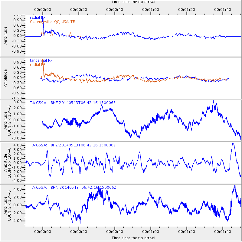
G59A Clarenceville, QC, USA - Earthquake Result Viewer
*The percent match for this event was below the threshold and hence no stack was calculated.
| Earthquake location: |
South Of Panama |
| Earthquake latitude/longitude: |
7.2/-82.3 |
| Earthquake time(UTC): |
2014/05/13 (133) 06:35:24 GMT |
| Earthquake Depth: |
10 km |
| Earthquake Magnitude: |
6.8 MWP, 6.8 MI |
| Earthquake Catalog/Contributor: |
NEIC PDE/NEIC COMCAT |
|
| Network: |
TA USArray Transportable Network (new EarthScope stations) |
| Station: |
G59A Clarenceville, QC, USA |
| Lat/Lon: |
45.08 N/73.18 W |
| Elevation: |
36 m |
|
| Distance: |
38.5 deg |
| Az: |
10.422 deg |
| Baz: |
194.673 deg |
| Ray Param: |
$rayparam |
*The percent match for this event was below the threshold and hence was not used in the summary stack. |
|
| Radial Match: |
31.583286 % |
| Radial Bump: |
400 |
| Transverse Match: |
15.932788 % |
| Transverse Bump: |
400 |
| SOD ConfigId: |
626651 |
| Insert Time: |
2014-05-27 07:24:42.814 +0000 |
| GWidth: |
2.5 |
| Max Bumps: |
400 |
| Tol: |
0.001 |
|
Signal To Noise
| Channel | StoN | STA | LTA |
| TA:G59A: :BHZ:20140513T06:42:16.150006Z | 4.2624087 | 1.6183653E-6 | 3.7968329E-7 |
| TA:G59A: :BHN:20140513T06:42:16.150006Z | 3.1814392 | 1.3996116E-6 | 4.3993035E-7 |
| TA:G59A: :BHE:20140513T06:42:16.150006Z | 4.6475153 | 2.0698778E-6 | 4.4537302E-7 |
| Arrivals |
| Ps | |
| PpPs | |
| PsPs/PpSs | |


