You are here: Home > Network List > CI - Caltech Regional Seismic Network Stations List
> Station MPM Manuel Prospect Mine, California, USA > Earthquake Result Viewer
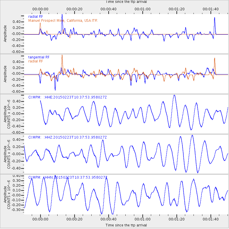
MPM Manuel Prospect Mine, California, USA - Earthquake Result Viewer
*The percent match for this event was below the threshold and hence no stack was calculated.
| Earthquake location: |
Off E. Coast Of N. Island, N.Z. |
| Earthquake latitude/longitude: |
-36.6/177.2 |
| Earthquake time(UTC): |
2015/02/23 (054) 10:25:06 GMT |
| Earthquake Depth: |
11 km |
| Earthquake Magnitude: |
5.1 MW |
| Earthquake Catalog/Contributor: |
ISC/ISC |
|
| Network: |
CI Caltech Regional Seismic Network |
| Station: |
MPM Manuel Prospect Mine, California, USA |
| Lat/Lon: |
36.06 N/117.49 W |
| Elevation: |
185 m |
|
| Distance: |
94.3 deg |
| Az: |
47.569 deg |
| Baz: |
227.117 deg |
| Ray Param: |
$rayparam |
*The percent match for this event was below the threshold and hence was not used in the summary stack. |
|
| Radial Match: |
41.172493 % |
| Radial Bump: |
400 |
| Transverse Match: |
34.68161 % |
| Transverse Bump: |
400 |
| SOD ConfigId: |
7019011 |
| Insert Time: |
2019-04-17 01:11:55.626 +0000 |
| GWidth: |
2.5 |
| Max Bumps: |
400 |
| Tol: |
0.001 |
|
Signal To Noise
| Channel | StoN | STA | LTA |
| CI:MPM: :HHZ:20150223T10:37:53.958027Z | 0.6547468 | 1.1889175E-7 | 1.8158433E-7 |
| CI:MPM: :HHN:20150223T10:37:53.958027Z | 1.6500592 | 2.8712603E-7 | 1.7400953E-7 |
| CI:MPM: :HHE:20150223T10:37:53.958027Z | 1.7681984 | 2.7022605E-7 | 1.5282563E-7 |
| Arrivals |
| Ps | |
| PpPs | |
| PsPs/PpSs | |


