
KURK Kurchatov, Kazakhstan - Earthquake Result Viewer
| ||||||||||||||||||
| ||||||||||||||||||
| ||||||||||||||||||
|
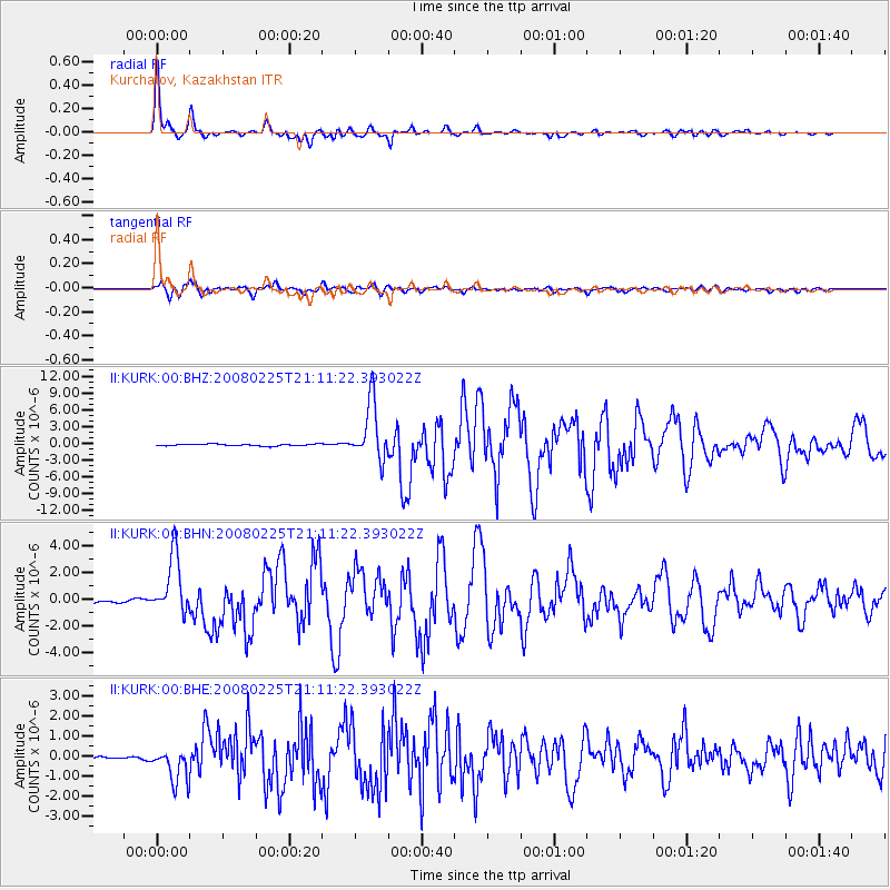
Signal To Noise
| Channel | StoN | STA | LTA |
| II:KURK:00:BHN:20080225T21:11:22.393022Z | 22.673439 | 2.2253723E-6 | 9.814887E-8 |
| II:KURK:00:BHE:20080225T21:11:22.393022Z | 13.078519 | 8.7959774E-7 | 6.725515E-8 |
| II:KURK:00:BHZ:20080225T21:11:22.393022Z | 31.735735 | 5.174652E-6 | 1.6305442E-7 |
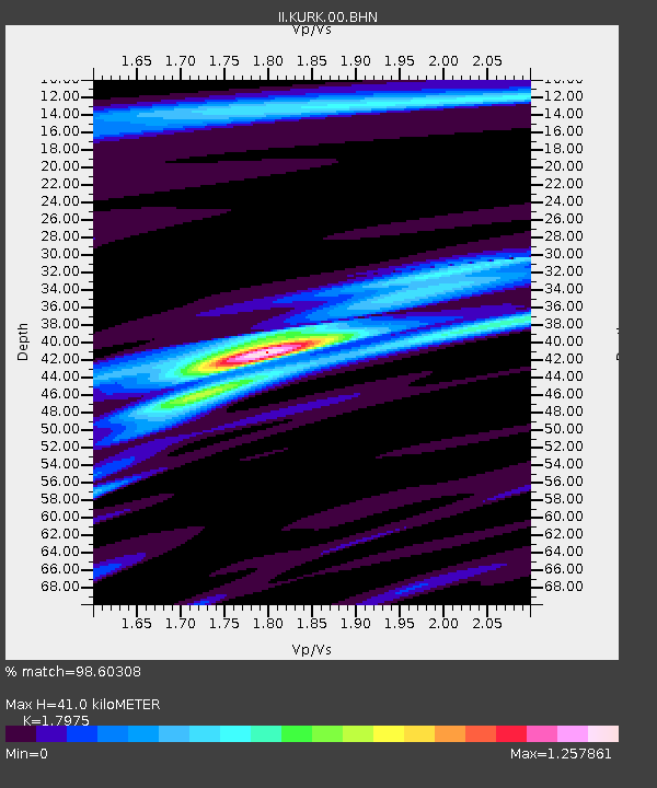
| Arrivals | |
| Ps | 5.3 SECOND |
| PpPs | 17 SECOND |
| PsPs/PpSs | 22 SECOND |

