
KURK Kurchatov, Kazakhstan - Earthquake Result Viewer
| ||||||||||||||||||
| ||||||||||||||||||
| ||||||||||||||||||
|
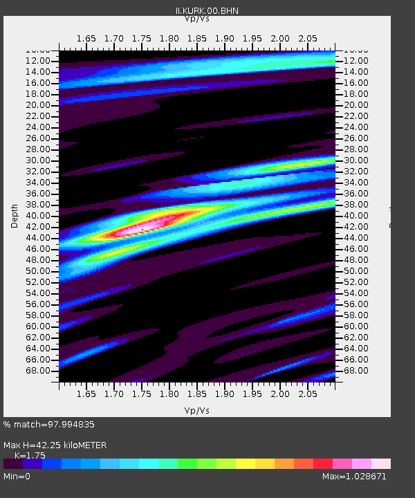
Signal To Noise
| Channel | StoN | STA | LTA |
| II:KURK:00:BHN:20080225T18:15:08.613013Z | 15.316185 | 1.2212604E-6 | 7.9736594E-8 |
| II:KURK:00:BHE:20080225T18:15:08.613013Z | 7.4430723 | 5.4935276E-7 | 7.3807264E-8 |
| II:KURK:00:BHZ:20080225T18:15:08.613013Z | 25.359625 | 2.884188E-6 | 1.1373149E-7 |
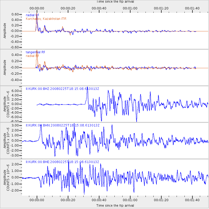
| Arrivals | |
| Ps | 5.1 SECOND |
| PpPs | 17 SECOND |
| PsPs/PpSs | 22 SECOND |

