You are here: Home > Network List > TA - USArray Transportable Network (new EarthScope stations) Stations List
> Station A21K Barrow, AK, USA > Earthquake Result Viewer
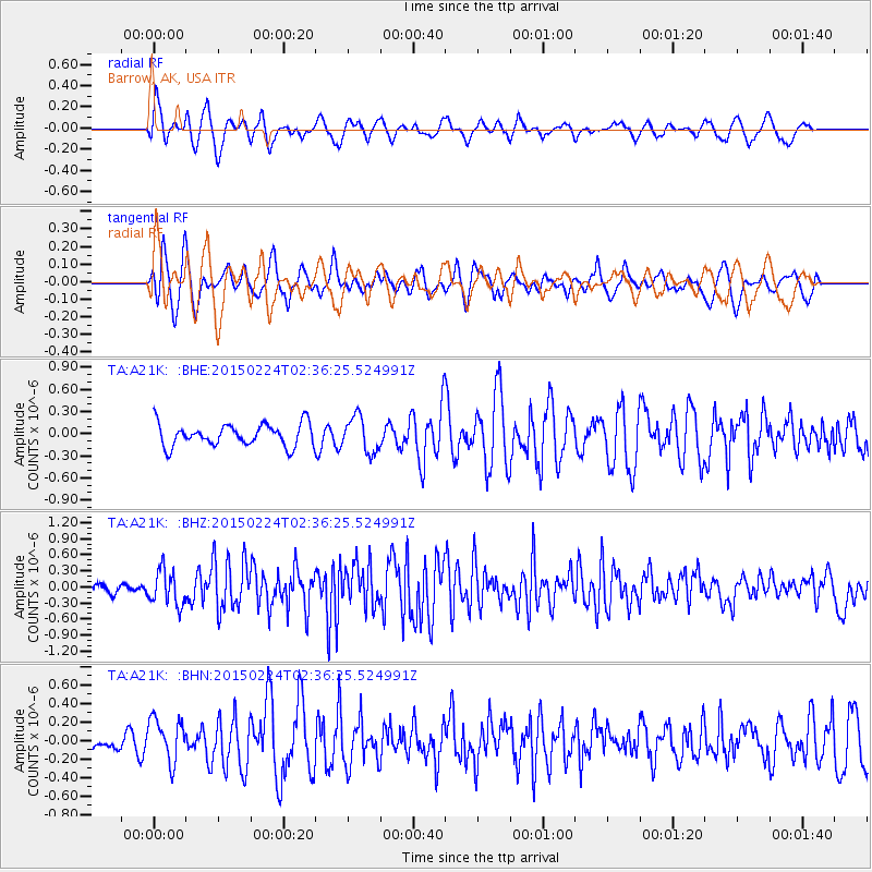
A21K Barrow, AK, USA - Earthquake Result Viewer
*The percent match for this event was below the threshold and hence no stack was calculated.
| Earthquake location: |
Off East Coast Of Honshu, Japan |
| Earthquake latitude/longitude: |
39.7/143.2 |
| Earthquake time(UTC): |
2015/02/24 (055) 02:28:54 GMT |
| Earthquake Depth: |
20 km |
| Earthquake Magnitude: |
5.8 MWB, 5.6 MWR, 5.8 MWC |
| Earthquake Catalog/Contributor: |
NEIC PDE/NEIC COMCAT |
|
| Network: |
TA USArray Transportable Network (new EarthScope stations) |
| Station: |
A21K Barrow, AK, USA |
| Lat/Lon: |
71.32 N/156.62 W |
| Elevation: |
577 m |
|
| Distance: |
43.5 deg |
| Az: |
23.962 deg |
| Baz: |
256.657 deg |
| Ray Param: |
$rayparam |
*The percent match for this event was below the threshold and hence was not used in the summary stack. |
|
| Radial Match: |
66.13038 % |
| Radial Bump: |
400 |
| Transverse Match: |
65.06327 % |
| Transverse Bump: |
377 |
| SOD ConfigId: |
7019011 |
| Insert Time: |
2019-04-17 01:23:56.645 +0000 |
| GWidth: |
2.5 |
| Max Bumps: |
400 |
| Tol: |
0.001 |
|
Signal To Noise
| Channel | StoN | STA | LTA |
| TA:A21K: :BHZ:20150224T02:36:25.524991Z | 1.9605852 | 3.3004508E-7 | 1.683401E-7 |
| TA:A21K: :BHN:20150224T02:36:25.524991Z | 1.2337714 | 2.3197111E-7 | 1.8801789E-7 |
| TA:A21K: :BHE:20150224T02:36:25.524991Z | 1.6150413 | 2.4144893E-7 | 1.4950015E-7 |
| Arrivals |
| Ps | |
| PpPs | |
| PsPs/PpSs | |


