KURK Kurchatov, Kazakhstan - Earthquake Result Viewer
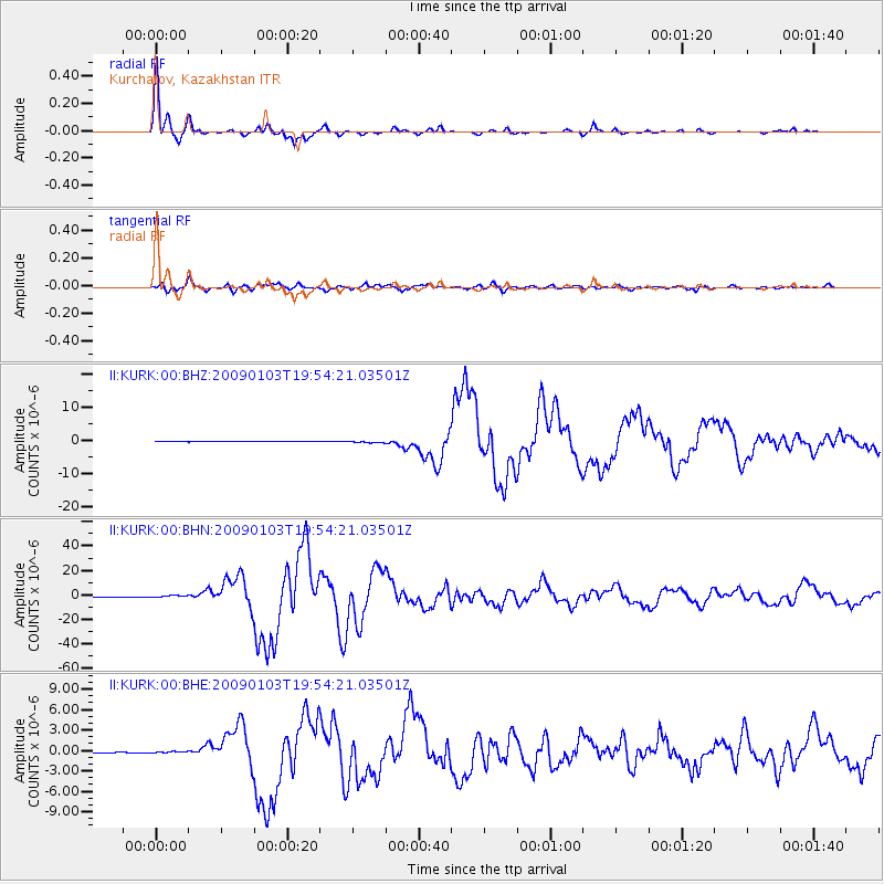
Earthquake location: Irian Jaya Region, Indonesia
Earthquake latitude/longitude: -0.4/132.9
Earthquake time(UTC): 2009/01/03 (003) 19:43:50 GMT
Earthquake Depth: 17 km
Earthquake Magnitude: 6.6 MB, 7.5 MS, 7.6 MW, 7.6 MW
Earthquake Catalog/Contributor: WHDF/NEIC
Network: II Global Seismograph Network (GSN - IRIS/IDA)
Station: KURK Kurchatov, Kazakhstan
Lat/Lon: 50.72 N/78.62 E
Elevation: 184 m
Distance: 68.5 deg
Az: 326.328 deg
Baz: 119.293 deg
Ray Param: 0.05621816
Estimated Moho Depth: 42.0 km
Estimated Crust Vp/Vs: 1.76
Assumed Crust Vp: 6.552 km/s
Estimated Crust Vs: 3.712 km/s
Estimated Crust Poisson's Ratio: 0.26
Radial Match: 99.13576 %
Radial Bump: 277
Transverse Match: 96.044334 %
Transverse Bump: 400
SOD ConfigId: 2834
Insert Time: 2010-03-01 22:11:19.284 +0000
GWidth: 2.5
Max Bumps: 400
Tol: 0.001

Signal To Noise

ChannelStoNSTALTA
II:KURK:00:BHN:20090103T19:54:21.03501Z14.0358937.5859515E-75.40468E-8
II:KURK:00:BHE:20090103T19:54:21.03501Z2.34132391.1990892E-75.1214155E-8
II:KURK:00:BHZ:20090103T19:54:21.03501Z5.4283682.634632E-74.8534513E-8
Arrivals
Ps5.1 SECOND
PpPs17 SECOND
PsPs/PpSs22 SECOND