You are here: Home > Network List > IU - Global Seismograph Network (GSN - IRIS/USGS) Stations List
> Station JOHN Johnston Island, USA > Earthquake Result Viewer
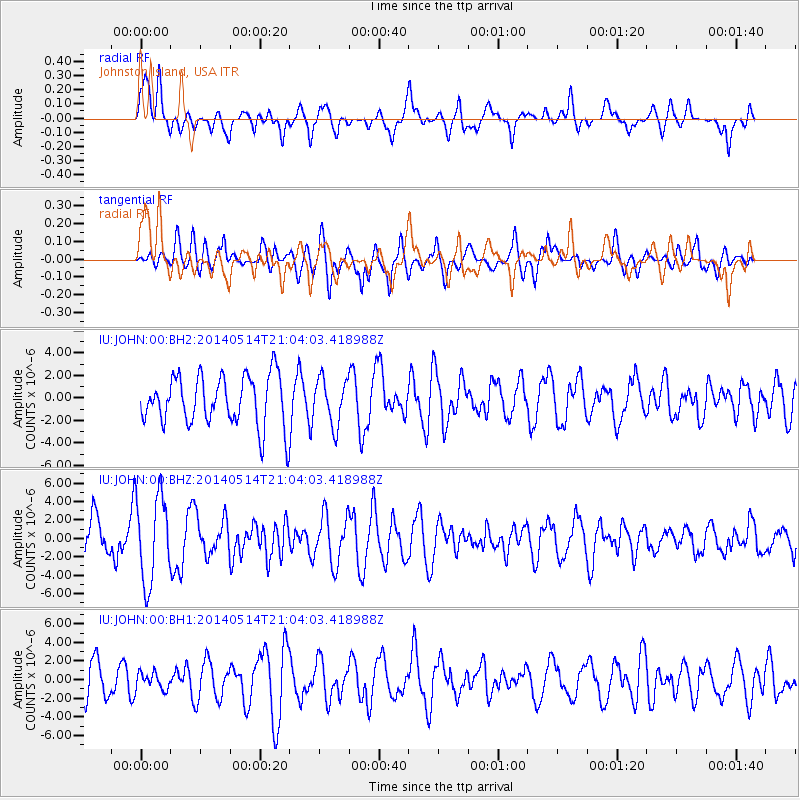
JOHN Johnston Island, USA - Earthquake Result Viewer
*The percent match for this event was below the threshold and hence no stack was calculated.
| Earthquake location: |
E. Caroline Islands, Micronesia |
| Earthquake latitude/longitude: |
6.5/144.9 |
| Earthquake time(UTC): |
2014/05/14 (134) 20:56:13 GMT |
| Earthquake Depth: |
10 km |
| Earthquake Magnitude: |
6.1 MI |
| Earthquake Catalog/Contributor: |
NEIC PDE/NEIC ALERT |
|
| Network: |
IU Global Seismograph Network (GSN - IRIS/USGS) |
| Station: |
JOHN Johnston Island, USA |
| Lat/Lon: |
16.73 N/169.53 W |
| Elevation: |
2.0 m |
|
| Distance: |
45.7 deg |
| Az: |
72.989 deg |
| Baz: |
262.624 deg |
| Ray Param: |
$rayparam |
*The percent match for this event was below the threshold and hence was not used in the summary stack. |
|
| Radial Match: |
43.867413 % |
| Radial Bump: |
400 |
| Transverse Match: |
50.38518 % |
| Transverse Bump: |
400 |
| SOD ConfigId: |
626651 |
| Insert Time: |
2014-05-28 21:19:05.392 +0000 |
| GWidth: |
2.5 |
| Max Bumps: |
400 |
| Tol: |
0.001 |
|
Signal To Noise
| Channel | StoN | STA | LTA |
| IU:JOHN:00:BHZ:20140514T21:04:03.418988Z | 1.9035202 | 4.708499E-6 | 2.4735746E-6 |
| IU:JOHN:00:BH1:20140514T21:04:03.418988Z | 0.47308525 | 9.0148006E-7 | 1.9055341E-6 |
| IU:JOHN:00:BH2:20140514T21:04:03.418988Z | 0.92244273 | 2.0418288E-6 | 2.213502E-6 |
| Arrivals |
| Ps | |
| PpPs | |
| PsPs/PpSs | |


