You are here: Home > Network List > US - United States National Seismic Network Stations List
> Station EGMT Eagleton, Montana, USA > Earthquake Result Viewer
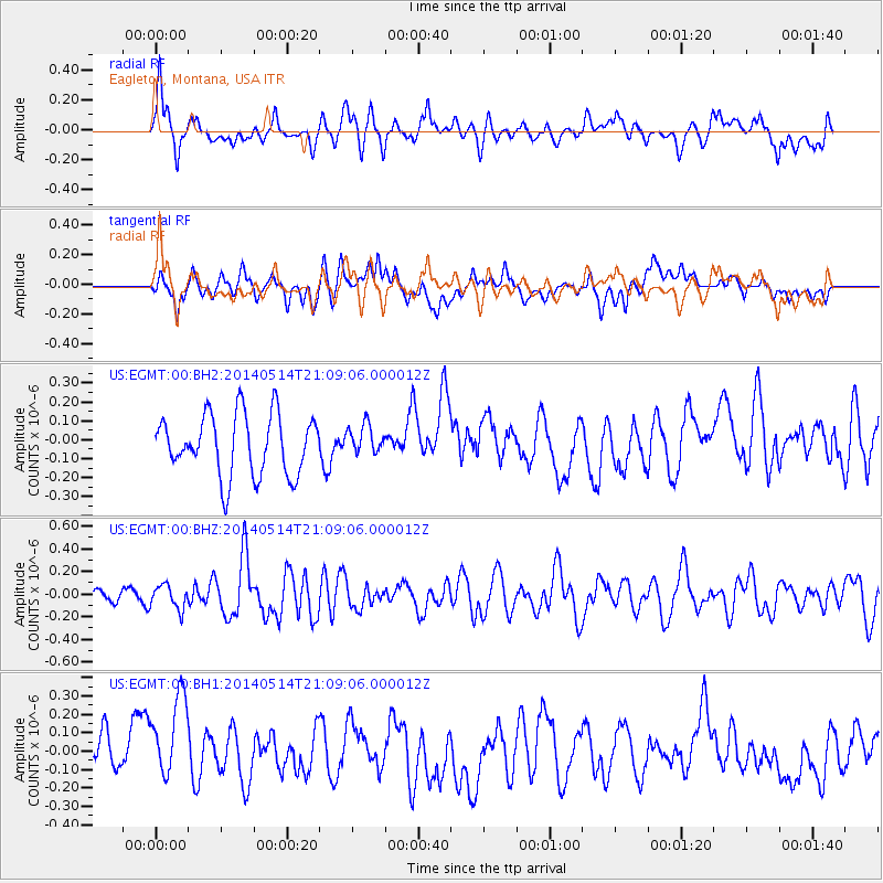
EGMT Eagleton, Montana, USA - Earthquake Result Viewer
*The percent match for this event was below the threshold and hence no stack was calculated.
| Earthquake location: |
E. Caroline Islands, Micronesia |
| Earthquake latitude/longitude: |
6.5/144.9 |
| Earthquake time(UTC): |
2014/05/14 (134) 20:56:13 GMT |
| Earthquake Depth: |
10 km |
| Earthquake Magnitude: |
6.1 MI |
| Earthquake Catalog/Contributor: |
NEIC PDE/NEIC ALERT |
|
| Network: |
US United States National Seismic Network |
| Station: |
EGMT Eagleton, Montana, USA |
| Lat/Lon: |
48.02 N/109.75 W |
| Elevation: |
1055 m |
|
| Distance: |
95.4 deg |
| Az: |
40.555 deg |
| Baz: |
285.748 deg |
| Ray Param: |
$rayparam |
*The percent match for this event was below the threshold and hence was not used in the summary stack. |
|
| Radial Match: |
45.476 % |
| Radial Bump: |
400 |
| Transverse Match: |
33.594727 % |
| Transverse Bump: |
400 |
| SOD ConfigId: |
626651 |
| Insert Time: |
2014-05-28 21:25:17.115 +0000 |
| GWidth: |
2.5 |
| Max Bumps: |
400 |
| Tol: |
0.001 |
|
Signal To Noise
| Channel | StoN | STA | LTA |
| US:EGMT:00:BHZ:20140514T21:09:06.000012Z | 2.3030314 | 1.0486265E-7 | 4.5532442E-8 |
| US:EGMT:00:BH1:20140514T21:09:06.000012Z | 1.5663688 | 2.8577114E-7 | 1.824418E-7 |
| US:EGMT:00:BH2:20140514T21:09:06.000012Z | 0.48385426 | 7.6991E-8 | 1.5912023E-7 |
| Arrivals |
| Ps | |
| PpPs | |
| PsPs/PpSs | |


