You are here: Home > Network List > US - United States National Seismic Network Stations List
> Station HAWA Hanford, Washington, USA > Earthquake Result Viewer
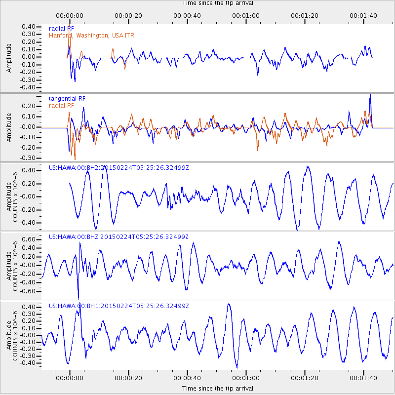
HAWA Hanford, Washington, USA - Earthquake Result Viewer
*The percent match for this event was below the threshold and hence no stack was calculated.
| Earthquake location: |
Jujuy Province, Argentina |
| Earthquake latitude/longitude: |
-22.7/-66.8 |
| Earthquake time(UTC): |
2015/02/24 (055) 05:13:51 GMT |
| Earthquake Depth: |
204 km |
| Earthquake Magnitude: |
5.3 MW |
| Earthquake Catalog/Contributor: |
ISC/ISC |
|
| Network: |
US United States National Seismic Network |
| Station: |
HAWA Hanford, Washington, USA |
| Lat/Lon: |
46.39 N/119.53 W |
| Elevation: |
364 m |
|
| Distance: |
83.7 deg |
| Az: |
326.324 deg |
| Baz: |
132.278 deg |
| Ray Param: |
$rayparam |
*The percent match for this event was below the threshold and hence was not used in the summary stack. |
|
| Radial Match: |
50.22644 % |
| Radial Bump: |
400 |
| Transverse Match: |
42.766136 % |
| Transverse Bump: |
400 |
| SOD ConfigId: |
7019011 |
| Insert Time: |
2019-04-17 01:35:58.019 +0000 |
| GWidth: |
2.5 |
| Max Bumps: |
400 |
| Tol: |
0.001 |
|
Signal To Noise
| Channel | StoN | STA | LTA |
| US:HAWA:00:BHZ:20150224T05:25:26.32499Z | 1.3367525 | 2.6418928E-7 | 1.9763513E-7 |
| US:HAWA:00:BH1:20150224T05:25:26.32499Z | 4.0168076 | 2.7536692E-7 | 6.8553675E-8 |
| US:HAWA:00:BH2:20150224T05:25:26.32499Z | 0.4665469 | 1.09336376E-7 | 2.3435238E-7 |
| Arrivals |
| Ps | |
| PpPs | |
| PsPs/PpSs | |


