You are here: Home > Network List > US - United States National Seismic Network Stations List
> Station LAO LASA Array, Montana, USA > Earthquake Result Viewer
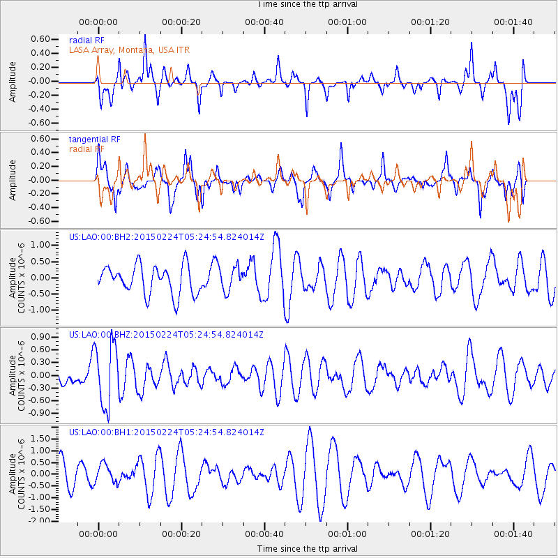
LAO LASA Array, Montana, USA - Earthquake Result Viewer
*The percent match for this event was below the threshold and hence no stack was calculated.
| Earthquake location: |
Jujuy Province, Argentina |
| Earthquake latitude/longitude: |
-22.7/-66.8 |
| Earthquake time(UTC): |
2015/02/24 (055) 05:13:51 GMT |
| Earthquake Depth: |
204 km |
| Earthquake Magnitude: |
5.3 MW |
| Earthquake Catalog/Contributor: |
ISC/ISC |
|
| Network: |
US United States National Seismic Network |
| Station: |
LAO LASA Array, Montana, USA |
| Lat/Lon: |
46.69 N/106.22 W |
| Elevation: |
902 m |
|
| Distance: |
77.7 deg |
| Az: |
333.397 deg |
| Baz: |
143.074 deg |
| Ray Param: |
$rayparam |
*The percent match for this event was below the threshold and hence was not used in the summary stack. |
|
| Radial Match: |
57.841183 % |
| Radial Bump: |
359 |
| Transverse Match: |
50.97041 % |
| Transverse Bump: |
382 |
| SOD ConfigId: |
7019011 |
| Insert Time: |
2019-04-17 01:36:00.792 +0000 |
| GWidth: |
2.5 |
| Max Bumps: |
400 |
| Tol: |
0.001 |
|
Signal To Noise
| Channel | StoN | STA | LTA |
| US:LAO:00:BHZ:20150224T05:24:54.824014Z | 4.1218596 | 7.3016497E-7 | 1.7714454E-7 |
| US:LAO:00:BH1:20150224T05:24:54.824014Z | 0.5487939 | 4.0424428E-7 | 7.366049E-7 |
| US:LAO:00:BH2:20150224T05:24:54.824014Z | 0.82301307 | 3.630776E-7 | 4.4115652E-7 |
| Arrivals |
| Ps | |
| PpPs | |
| PsPs/PpSs | |


