KURK Kurchatov, Kazakhstan - Earthquake Result Viewer
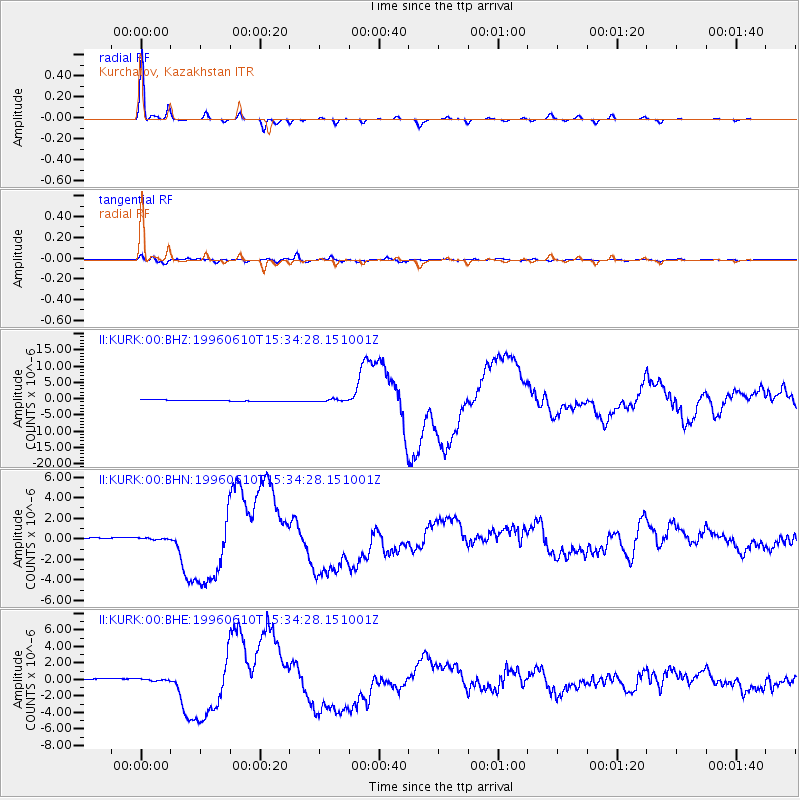
Earthquake location: Andreanof Islands, Aleutian Is.
Earthquake latitude/longitude: 51.5/-176.8
Earthquake time(UTC): 1996/06/10 (162) 15:24:56 GMT
Earthquake Depth: 26 km
Earthquake Magnitude: 5.9 MB, 7.1 MS, 7.2 UNKNOWN, 6.9 MS
Earthquake Catalog/Contributor: WHDF/NEIC
Network: II Global Seismograph Network (GSN - IRIS/IDA)
Station: KURK Kurchatov, Kazakhstan
Lat/Lon: 50.72 N/78.62 E
Elevation: 184 m
Distance: 59.8 deg
Az: 314.618 deg
Baz: 44.445 deg
Ray Param: 0.061893642
Estimated Moho Depth: 42.0 km
Estimated Crust Vp/Vs: 1.67
Assumed Crust Vp: 6.552 km/s
Estimated Crust Vs: 3.924 km/s
Estimated Crust Poisson's Ratio: 0.22
Radial Match: 98.74649 %
Radial Bump: 211
Transverse Match: 91.338905 %
Transverse Bump: 400
SOD ConfigId: 6273
Insert Time: 2010-03-01 22:14:17.061 +0000
GWidth: 2.5
Max Bumps: 400
Tol: 0.001

Signal To Noise

ChannelStoNSTALTA
II:KURK:00:BHN:19960610T15:34:28.151001Z0.735113561.0024909E-71.3637225E-7
II:KURK:00:BHE:19960610T15:34:28.151001Z0.87909411.2336393E-71.4033074E-7
II:KURK:00:BHZ:19960610T15:34:28.151001Z1.6760683.2127687E-71.9168488E-7
Arrivals
Ps4.5 SECOND
PpPs16 SECOND
PsPs/PpSs21 SECOND