KURK Kurchatov, Kazakhstan - Earthquake Result Viewer
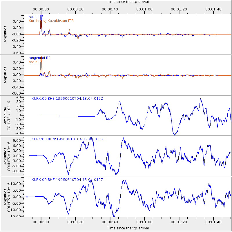
Earthquake location: Andreanof Islands, Aleutian Is.
Earthquake latitude/longitude: 51.6/-177.6
Earthquake time(UTC): 1996/06/10 (162) 04:03:35 GMT
Earthquake Depth: 33 km
Earthquake Magnitude: 6.6 MB, 7.6 MS, 7.9 UNKNOWN, 7.4 MS
Earthquake Catalog/Contributor: WHDF/NEIC
Network: II Global Seismograph Network (GSN - IRIS/IDA)
Station: KURK Kurchatov, Kazakhstan
Lat/Lon: 50.72 N/78.62 E
Elevation: 184 m
Distance: 59.4 deg
Az: 314.17 deg
Baz: 44.772 deg
Ray Param: 0.06214408
Estimated Moho Depth: 41.0 km
Estimated Crust Vp/Vs: 1.72
Assumed Crust Vp: 6.552 km/s
Estimated Crust Vs: 3.81 km/s
Estimated Crust Poisson's Ratio: 0.24
Radial Match: 98.21251 %
Radial Bump: 341
Transverse Match: 90.6248 %
Transverse Bump: 400
SOD ConfigId: 6273
Insert Time: 2010-03-01 22:14:19.997 +0000
GWidth: 2.5
Max Bumps: 400
Tol: 0.001

Signal To Noise

ChannelStoNSTALTA
II:KURK:00:BHN:19960610T04:13:04.012Z4.68122671.7783922E-63.7989878E-7
II:KURK:00:BHE:19960610T04:13:04.012Z8.1760622.228854E-62.726073E-7
II:KURK:00:BHZ:19960610T04:13:04.012Z15.1643886.348531E-64.1864735E-7
Arrivals
Ps4.7 SECOND
PpPs16 SECOND
PsPs/PpSs21 SECOND