
KURK Kurchatov, Kazakhstan - Earthquake Result Viewer
| ||||||||||||||||||
| ||||||||||||||||||
| ||||||||||||||||||
|
Signal To Noise
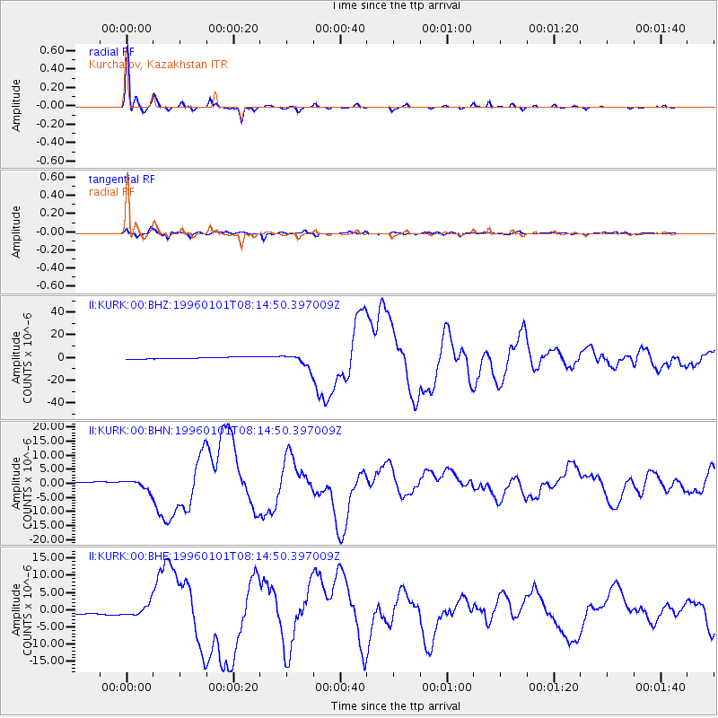
| Channel | StoN | STA | LTA |
| II:KURK:00:BHN:19960101T08:14:50.397009Z | 5.5008 | 1.7739005E-6 | 3.2248047E-7 |
| II:KURK:00:BHE:19960101T08:14:50.397009Z | 5.7712126 | 1.7403478E-6 | 3.015567E-7 |
| II:KURK:00:BHZ:19960101T08:14:50.397009Z | 7.8745484 | 5.8192313E-6 | 7.389924E-7 |
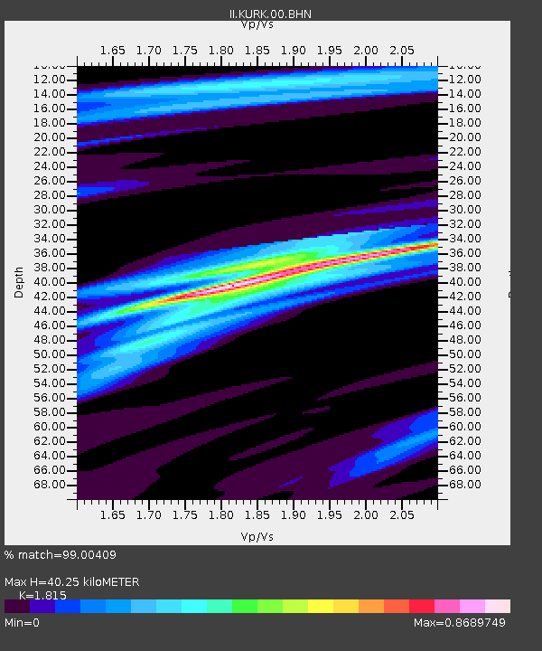
| Arrivals | |
| Ps | 5.2 SECOND |
| PpPs | 17 SECOND |
| PsPs/PpSs | 22 SECOND |

