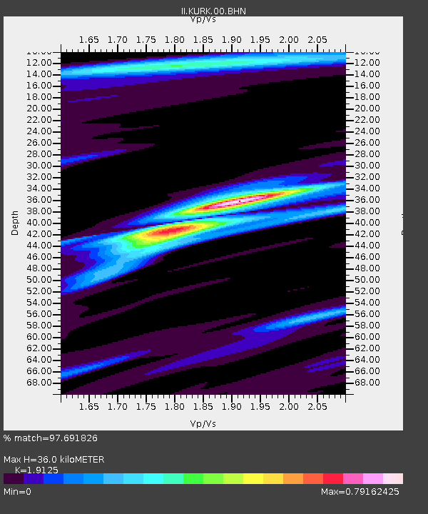
KURK Kurchatov, Kazakhstan - Earthquake Result Viewer
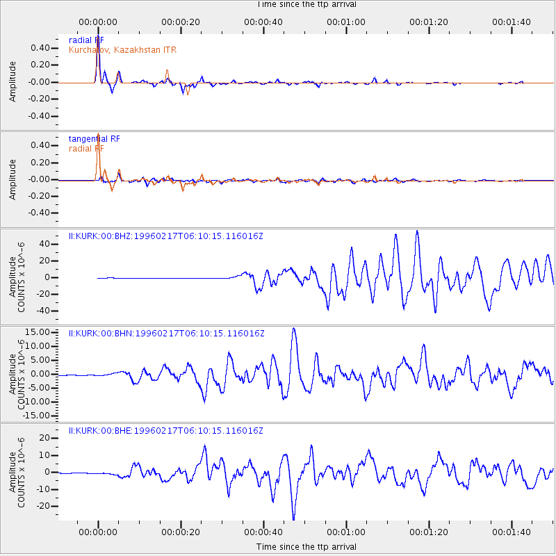
Earthquake location: Irian Jaya Region, Indonesia
Earthquake latitude/longitude: -0.9/137.0
Earthquake time(UTC): 1996/02/17 (048) 05:59:29 GMT
Earthquake Depth: 33 km
Earthquake Magnitude: 6.5 MB, 8.1 MS, 7.9 UNKNOWN
Earthquake Catalog/Contributor: WHDF/NEIC
Network: II Global Seismograph Network (GSN - IRIS/IDA)
Station: KURK Kurchatov, Kazakhstan
Lat/Lon: 50.72 N/78.62 E
Elevation: 184 m
Distance: 71.3 deg
Az: 325.137 deg
Baz: 115.969 deg
Ray Param: 0.05435747
Estimated Moho Depth: 36.0 km
Estimated Crust Vp/Vs: 1.91
Assumed Crust Vp: 6.552 km/s
Estimated Crust Vs: 3.426 km/s
Estimated Crust Poisson's Ratio: 0.31
Radial Match: 97.691826 %
Radial Bump: 224
Transverse Match: 87.207 %
Transverse Bump: 400
SOD ConfigId: 6273
Insert Time: 2010-03-01 22:14:58.360 +0000
GWidth: 2.5
Max Bumps: 400
Tol: 0.001

Signal To Noise

ChannelStoNSTALTA
II:KURK:00:BHN:19960217T06:10:15.116016Z2.99296764.4548824E-71.4884499E-7
II:KURK:00:BHE:19960217T06:10:15.116016Z3.9088435.952261E-71.5227678E-7
II:KURK:00:BHZ:19960217T06:10:15.116016Z9.0168121.8557499E-62.0580997E-7
Arrivals
Ps5.2 SECOND
PpPs15 SECOND
PsPs/PpSs21 SECOND