KURK Kurchatov, Kazakhstan - Earthquake Result Viewer
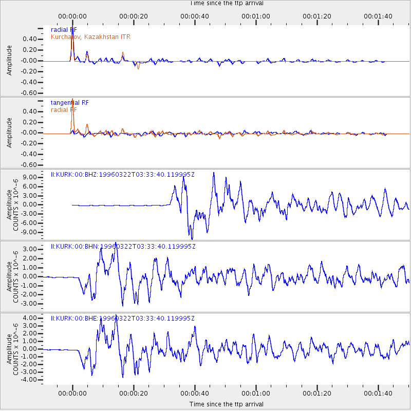
Earthquake location: Rat Islands, Aleutian Islands
Earthquake latitude/longitude: 51.2/178.7
Earthquake time(UTC): 1996/03/22 (082) 03:24:20 GMT
Earthquake Depth: 20 km
Earthquake Magnitude: 5.7 MB, 6.6 MS, 6.8 UNKNOWN, 6.6 ML
Earthquake Catalog/Contributor: WHDF/NEIC
Network: II Global Seismograph Network (GSN - IRIS/IDA)
Station: KURK Kurchatov, Kazakhstan
Lat/Lon: 50.72 N/78.62 E
Elevation: 184 m
Distance: 58.0 deg
Az: 312.418 deg
Baz: 46.911 deg
Ray Param: 0.06312084
Estimated Moho Depth: 41.75 km
Estimated Crust Vp/Vs: 1.72
Assumed Crust Vp: 6.552 km/s
Estimated Crust Vs: 3.804 km/s
Estimated Crust Poisson's Ratio: 0.25
Radial Match: 97.72028 %
Radial Bump: 248
Transverse Match: 90.810555 %
Transverse Bump: 400
SOD ConfigId: 6273
Insert Time: 2010-03-01 22:15:18.791 +0000
GWidth: 2.5
Max Bumps: 400
Tol: 0.001

Signal To Noise

ChannelStoNSTALTA
II:KURK:00:BHN:19960322T03:33:40.119995Z9.4988367.620711E-78.022785E-8
II:KURK:00:BHE:19960322T03:33:40.119995Z25.9581831.0100487E-63.8910606E-8
II:KURK:00:BHZ:19960322T03:33:40.119995Z58.473382.6051598E-64.455292E-8
Arrivals
Ps4.9 SECOND
PpPs16 SECOND
PsPs/PpSs21 SECOND