You are here: Home > Network List > US - United States National Seismic Network Stations List
> Station MSO Missoula, Montana, USA > Earthquake Result Viewer
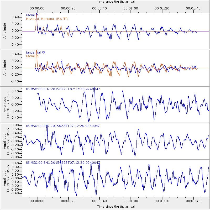
MSO Missoula, Montana, USA - Earthquake Result Viewer
*The percent match for this event was below the threshold and hence no stack was calculated.
| Earthquake location: |
Southeast Of Honshu, Japan |
| Earthquake latitude/longitude: |
31.1/141.9 |
| Earthquake time(UTC): |
2015/02/25 (056) 07:01:01 GMT |
| Earthquake Depth: |
10 km |
| Earthquake Magnitude: |
5.7 MB |
| Earthquake Catalog/Contributor: |
NEIC PDE/NEIC COMCAT |
|
| Network: |
US United States National Seismic Network |
| Station: |
MSO Missoula, Montana, USA |
| Lat/Lon: |
46.83 N/113.94 W |
| Elevation: |
1264 m |
|
| Distance: |
76.8 deg |
| Az: |
43.141 deg |
| Baz: |
301.308 deg |
| Ray Param: |
$rayparam |
*The percent match for this event was below the threshold and hence was not used in the summary stack. |
|
| Radial Match: |
62.947533 % |
| Radial Bump: |
400 |
| Transverse Match: |
50.86035 % |
| Transverse Bump: |
400 |
| SOD ConfigId: |
7019011 |
| Insert Time: |
2019-04-17 01:59:56.712 +0000 |
| GWidth: |
2.5 |
| Max Bumps: |
400 |
| Tol: |
0.001 |
|
Signal To Noise
| Channel | StoN | STA | LTA |
| US:MSO:00:BHZ:20150225T07:12:20.924004Z | 1.3512499 | 2.23305E-7 | 1.652581E-7 |
| US:MSO:00:BH1:20150225T07:12:20.924004Z | 0.9806578 | 1.1307006E-7 | 1.1530021E-7 |
| US:MSO:00:BH2:20150225T07:12:20.924004Z | 2.3219068 | 3.231664E-7 | 1.3918147E-7 |
| Arrivals |
| Ps | |
| PpPs | |
| PsPs/PpSs | |


