You are here: Home > Network List > UW - Pacific Northwest Regional Seismic Network Stations List
> Station MRBL Marblemount, WA, USA > Earthquake Result Viewer
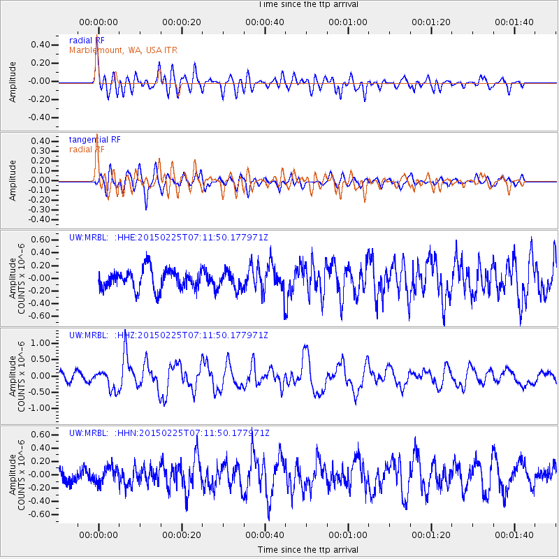
MRBL Marblemount, WA, USA - Earthquake Result Viewer
*The percent match for this event was below the threshold and hence no stack was calculated.
| Earthquake location: |
Southeast Of Honshu, Japan |
| Earthquake latitude/longitude: |
31.1/141.9 |
| Earthquake time(UTC): |
2015/02/25 (056) 07:01:01 GMT |
| Earthquake Depth: |
10 km |
| Earthquake Magnitude: |
5.7 MB |
| Earthquake Catalog/Contributor: |
NEIC PDE/NEIC COMCAT |
|
| Network: |
UW Pacific Northwest Regional Seismic Network |
| Station: |
MRBL Marblemount, WA, USA |
| Lat/Lon: |
48.52 N/121.48 W |
| Elevation: |
75 m |
|
| Distance: |
71.5 deg |
| Az: |
44.143 deg |
| Baz: |
296.017 deg |
| Ray Param: |
$rayparam |
*The percent match for this event was below the threshold and hence was not used in the summary stack. |
|
| Radial Match: |
71.69606 % |
| Radial Bump: |
400 |
| Transverse Match: |
70.756165 % |
| Transverse Bump: |
400 |
| SOD ConfigId: |
7019011 |
| Insert Time: |
2019-04-17 02:00:09.509 +0000 |
| GWidth: |
2.5 |
| Max Bumps: |
400 |
| Tol: |
0.001 |
|
Signal To Noise
| Channel | StoN | STA | LTA |
| UW:MRBL: :HHZ:20150225T07:11:50.177971Z | 2.5289896 | 3.064518E-7 | 1.2117559E-7 |
| UW:MRBL: :HHN:20150225T07:11:50.177971Z | 1.3519995 | 1.292799E-7 | 9.562126E-8 |
| UW:MRBL: :HHE:20150225T07:11:50.177971Z | 0.88279676 | 1.3926412E-7 | 1.5775332E-7 |
| Arrivals |
| Ps | |
| PpPs | |
| PsPs/PpSs | |


