You are here: Home > Network List > TA - USArray Transportable Network (new EarthScope stations) Stations List
> Station M47A Cromwell, IN, USA > Earthquake Result Viewer
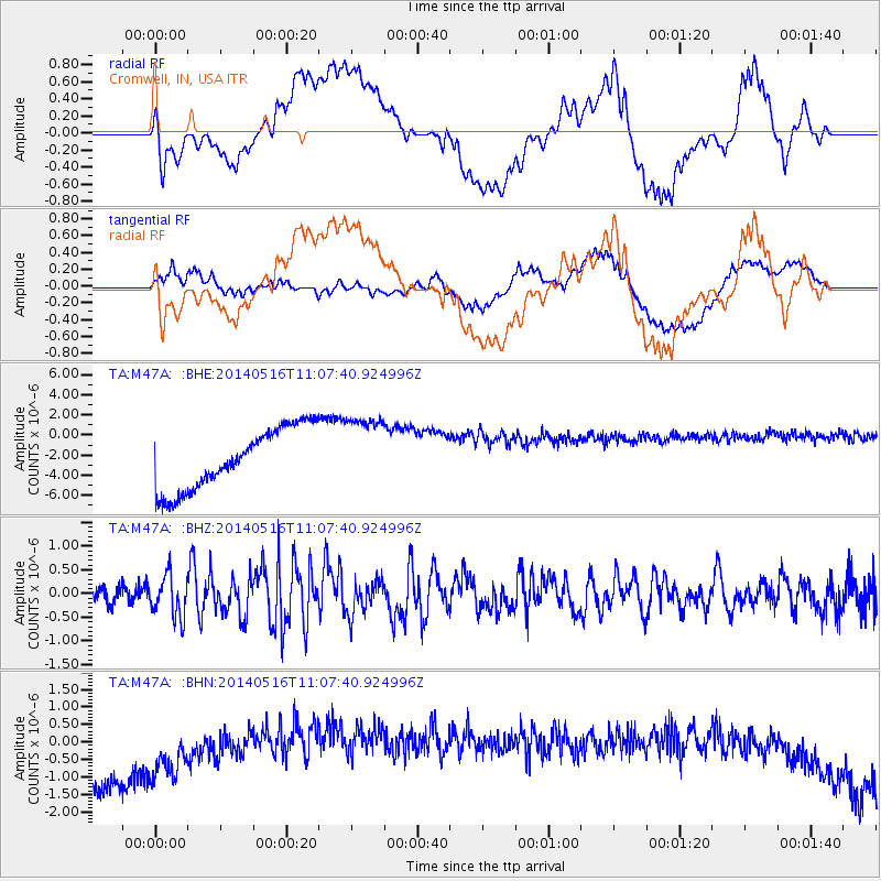
M47A Cromwell, IN, USA - Earthquake Result Viewer
*The percent match for this event was below the threshold and hence no stack was calculated.
| Earthquake location: |
Leeward Islands |
| Earthquake latitude/longitude: |
17.1/-60.4 |
| Earthquake time(UTC): |
2014/05/16 (136) 11:01:42 GMT |
| Earthquake Depth: |
24 km |
| Earthquake Magnitude: |
6.0 MWP, 6.0 MI |
| Earthquake Catalog/Contributor: |
NEIC PDE/NEIC COMCAT |
|
| Network: |
TA USArray Transportable Network (new EarthScope stations) |
| Station: |
M47A Cromwell, IN, USA |
| Lat/Lon: |
41.36 N/85.62 W |
| Elevation: |
283 m |
|
| Distance: |
32.5 deg |
| Az: |
323.314 deg |
| Baz: |
130.621 deg |
| Ray Param: |
$rayparam |
*The percent match for this event was below the threshold and hence was not used in the summary stack. |
|
| Radial Match: |
10.533284 % |
| Radial Bump: |
400 |
| Transverse Match: |
36.36824 % |
| Transverse Bump: |
400 |
| SOD ConfigId: |
626651 |
| Insert Time: |
2014-05-30 12:00:14.421 +0000 |
| GWidth: |
2.5 |
| Max Bumps: |
400 |
| Tol: |
0.001 |
|
Signal To Noise
| Channel | StoN | STA | LTA |
| TA:M47A: :BHZ:20140516T11:07:40.924996Z | 2.234766 | 4.413635E-7 | 1.9749875E-7 |
| TA:M47A: :BHN:20140516T11:07:40.924996Z | 0.7442812 | 1.8820898E-6 | 2.528735E-6 |
| TA:M47A: :BHE:20140516T11:07:40.924996Z | 1.2290784 | 3.7123316E-6 | 3.0204187E-6 |
| Arrivals |
| Ps | |
| PpPs | |
| PsPs/PpSs | |


