You are here: Home > Network List > TA - USArray Transportable Network (new EarthScope stations) Stations List
> Station MDND Maddock, ND, USA > Earthquake Result Viewer
MDND Maddock, ND, USA - Earthquake Result Viewer
*The percent match for this event was below the threshold and hence no stack was calculated.
| Earthquake location: |
Leeward Islands |
| Earthquake latitude/longitude: |
17.1/-60.4 |
| Earthquake time(UTC): |
2014/05/16 (136) 11:01:42 GMT |
| Earthquake Depth: |
24 km |
| Earthquake Magnitude: |
6.0 MWP, 6.0 MI |
| Earthquake Catalog/Contributor: |
NEIC PDE/NEIC COMCAT |
|
| Network: |
TA USArray Transportable Network (new EarthScope stations) |
| Station: |
MDND Maddock, ND, USA |
| Lat/Lon: |
47.85 N/99.60 W |
| Elevation: |
479 m |
|
| Distance: |
44.4 deg |
| Az: |
322.477 deg |
| Baz: |
120.136 deg |
| Ray Param: |
$rayparam |
*The percent match for this event was below the threshold and hence was not used in the summary stack. |
|
| Radial Match: |
75.57628 % |
| Radial Bump: |
343 |
| Transverse Match: |
55.14351 % |
| Transverse Bump: |
400 |
| SOD ConfigId: |
626651 |
| Insert Time: |
2014-05-30 12:00:21.711 +0000 |
| GWidth: |
2.5 |
| Max Bumps: |
400 |
| Tol: |
0.001 |
|
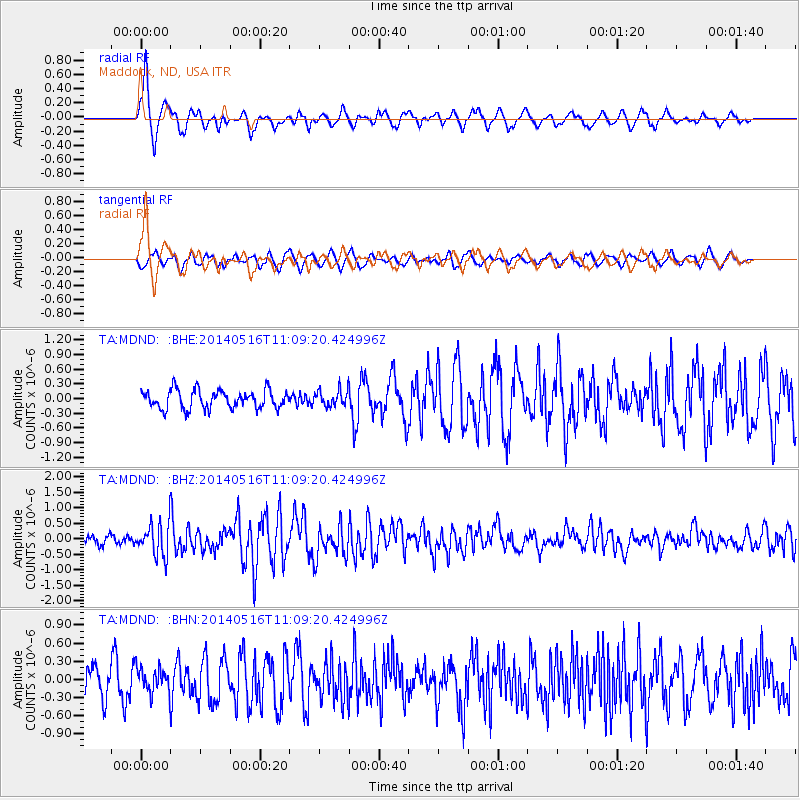
Signal To Noise
| Channel | StoN | STA | LTA |
| TA:MDND: :BHZ:20140516T11:09:20.424996Z | 4.099987 | 5.1177676E-7 | 1.2482398E-7 |
| TA:MDND: :BHN:20140516T11:09:20.424996Z | 0.8173205 | 2.0820077E-7 | 2.5473577E-7 |
| TA:MDND: :BHE:20140516T11:09:20.424996Z | 0.8876463 | 1.6604669E-7 | 1.8706403E-7 |
| Arrivals |
| Ps | |
| PpPs | |
| PsPs/PpSs | |


