You are here: Home > Network List > US - United States National Seismic Network Stations List
> Station AMTX Amarillo, Texas, USA > Earthquake Result Viewer
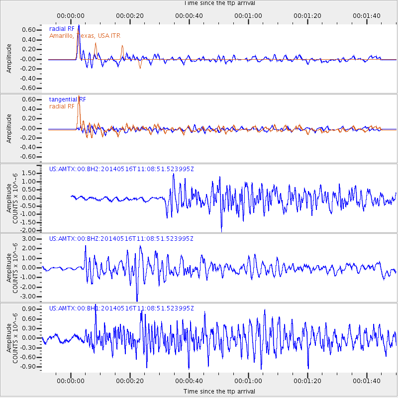
AMTX Amarillo, Texas, USA - Earthquake Result Viewer
*The percent match for this event was below the threshold and hence no stack was calculated.
| Earthquake location: |
Leeward Islands |
| Earthquake latitude/longitude: |
17.1/-60.4 |
| Earthquake time(UTC): |
2014/05/16 (136) 11:01:42 GMT |
| Earthquake Depth: |
24 km |
| Earthquake Magnitude: |
6.0 MWP, 6.0 MI |
| Earthquake Catalog/Contributor: |
NEIC PDE/NEIC COMCAT |
|
| Network: |
US United States National Seismic Network |
| Station: |
AMTX Amarillo, Texas, USA |
| Lat/Lon: |
34.53 N/101.41 W |
| Elevation: |
1010 m |
|
| Distance: |
40.5 deg |
| Az: |
303.435 deg |
| Baz: |
104.82 deg |
| Ray Param: |
$rayparam |
*The percent match for this event was below the threshold and hence was not used in the summary stack. |
|
| Radial Match: |
89.517105 % |
| Radial Bump: |
400 |
| Transverse Match: |
84.451546 % |
| Transverse Bump: |
400 |
| SOD ConfigId: |
626651 |
| Insert Time: |
2014-05-30 12:02:37.351 +0000 |
| GWidth: |
2.5 |
| Max Bumps: |
400 |
| Tol: |
0.001 |
|
Signal To Noise
| Channel | StoN | STA | LTA |
| US:AMTX:00:BHZ:20140516T11:08:51.523995Z | 4.5444636 | 4.5044882E-7 | 9.9120356E-8 |
| US:AMTX:00:BH1:20140516T11:08:51.523995Z | 1.0602012 | 7.759953E-8 | 7.3193206E-8 |
| US:AMTX:00:BH2:20140516T11:08:51.523995Z | 2.191088 | 1.8382984E-7 | 8.389888E-8 |
| Arrivals |
| Ps | |
| PpPs | |
| PsPs/PpSs | |


