You are here: Home > Network List > US - United States National Seismic Network Stations List
> Station GLMI Grayling, Michigan, USA > Earthquake Result Viewer
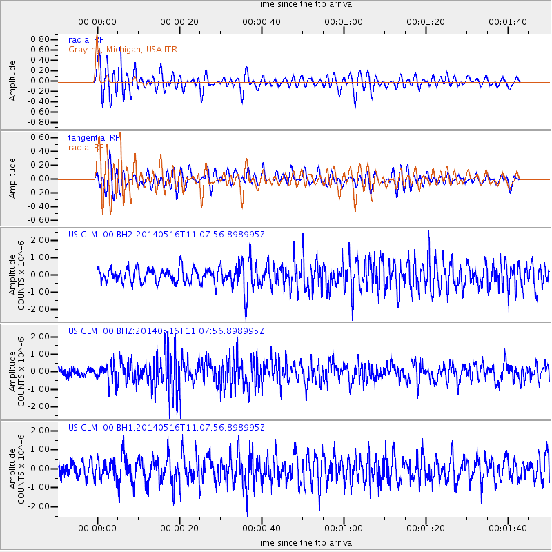
GLMI Grayling, Michigan, USA - Earthquake Result Viewer
*The percent match for this event was below the threshold and hence no stack was calculated.
| Earthquake location: |
Leeward Islands |
| Earthquake latitude/longitude: |
17.1/-60.4 |
| Earthquake time(UTC): |
2014/05/16 (136) 11:01:42 GMT |
| Earthquake Depth: |
24 km |
| Earthquake Magnitude: |
6.0 MWP, 6.0 MI |
| Earthquake Catalog/Contributor: |
NEIC PDE/NEIC COMCAT |
|
| Network: |
US United States National Seismic Network |
| Station: |
GLMI Grayling, Michigan, USA |
| Lat/Lon: |
44.82 N/84.62 W |
| Elevation: |
387 m |
|
| Distance: |
34.3 deg |
| Az: |
328.812 deg |
| Baz: |
135.895 deg |
| Ray Param: |
$rayparam |
*The percent match for this event was below the threshold and hence was not used in the summary stack. |
|
| Radial Match: |
67.97072 % |
| Radial Bump: |
400 |
| Transverse Match: |
49.55015 % |
| Transverse Bump: |
400 |
| SOD ConfigId: |
626651 |
| Insert Time: |
2014-05-30 12:03:21.501 +0000 |
| GWidth: |
2.5 |
| Max Bumps: |
400 |
| Tol: |
0.001 |
|
Signal To Noise
| Channel | StoN | STA | LTA |
| US:GLMI:00:BHZ:20140516T11:07:56.898995Z | 1.9825469 | 4.7576555E-7 | 2.3997694E-7 |
| US:GLMI:00:BH1:20140516T11:07:56.898995Z | 0.9949928 | 4.3352944E-7 | 4.3571114E-7 |
| US:GLMI:00:BH2:20140516T11:07:56.898995Z | 1.2499877 | 4.789618E-7 | 3.831732E-7 |
| Arrivals |
| Ps | |
| PpPs | |
| PsPs/PpSs | |


