You are here: Home > Network List > TA - USArray Transportable Network (new EarthScope stations) Stations List
> Station Z41A Richland Creek Farm, El Dorado, AR, USA > Earthquake Result Viewer
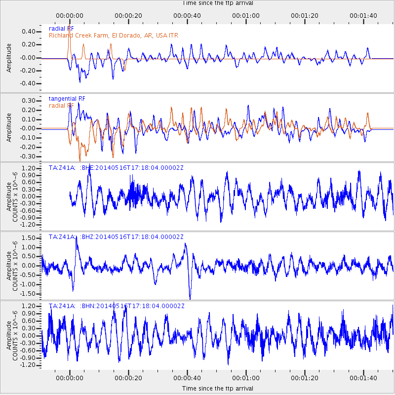
Z41A Richland Creek Farm, El Dorado, AR, USA - Earthquake Result Viewer
*The percent match for this event was below the threshold and hence no stack was calculated.
| Earthquake location: |
Northern Chile |
| Earthquake latitude/longitude: |
-23.5/-68.6 |
| Earthquake time(UTC): |
2014/05/16 (136) 17:08:32 GMT |
| Earthquake Depth: |
103 km |
| Earthquake Magnitude: |
5.5 MWR |
| Earthquake Catalog/Contributor: |
NEIC PDE/NEIC COMCAT |
|
| Network: |
TA USArray Transportable Network (new EarthScope stations) |
| Station: |
Z41A Richland Creek Farm, El Dorado, AR, USA |
| Lat/Lon: |
33.26 N/92.80 W |
| Elevation: |
62 m |
|
| Distance: |
60.9 deg |
| Az: |
336.839 deg |
| Baz: |
154.464 deg |
| Ray Param: |
$rayparam |
*The percent match for this event was below the threshold and hence was not used in the summary stack. |
|
| Radial Match: |
47.57975 % |
| Radial Bump: |
378 |
| Transverse Match: |
57.3014 % |
| Transverse Bump: |
400 |
| SOD ConfigId: |
626651 |
| Insert Time: |
2014-05-30 18:00:17.668 +0000 |
| GWidth: |
2.5 |
| Max Bumps: |
400 |
| Tol: |
0.001 |
|
Signal To Noise
| Channel | StoN | STA | LTA |
| TA:Z41A: :BHZ:20140516T17:18:04.00002Z | 2.9428742 | 6.9904286E-7 | 2.3753745E-7 |
| TA:Z41A: :BHN:20140516T17:18:04.00002Z | 1.2869537 | 4.7391362E-7 | 3.6824449E-7 |
| TA:Z41A: :BHE:20140516T17:18:04.00002Z | 0.654055 | 2.638311E-7 | 4.0337756E-7 |
| Arrivals |
| Ps | |
| PpPs | |
| PsPs/PpSs | |


