You are here: Home > Network List > TA - USArray Transportable Network (new EarthScope stations) Stations List
> Station J04D Umpqua National Forest, Toketee, OR, USA > Earthquake Result Viewer
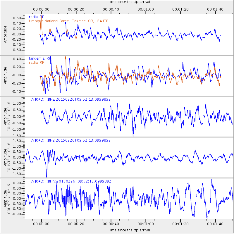
J04D Umpqua National Forest, Toketee, OR, USA - Earthquake Result Viewer
*The percent match for this event was below the threshold and hence no stack was calculated.
| Earthquake location: |
Andreanof Islands, Aleutian Is. |
| Earthquake latitude/longitude: |
50.1/-175.8 |
| Earthquake time(UTC): |
2015/02/26 (057) 09:45:37 GMT |
| Earthquake Depth: |
24 km |
| Earthquake Magnitude: |
5.2 MW |
| Earthquake Catalog/Contributor: |
ISC/ISC |
|
| Network: |
TA USArray Transportable Network (new EarthScope stations) |
| Station: |
J04D Umpqua National Forest, Toketee, OR, USA |
| Lat/Lon: |
43.24 N/122.11 W |
| Elevation: |
1948 m |
|
| Distance: |
36.8 deg |
| Az: |
79.518 deg |
| Baz: |
299.911 deg |
| Ray Param: |
$rayparam |
*The percent match for this event was below the threshold and hence was not used in the summary stack. |
|
| Radial Match: |
55.805893 % |
| Radial Bump: |
400 |
| Transverse Match: |
59.609825 % |
| Transverse Bump: |
400 |
| SOD ConfigId: |
7019011 |
| Insert Time: |
2019-04-17 02:27:24.650 +0000 |
| GWidth: |
2.5 |
| Max Bumps: |
400 |
| Tol: |
0.001 |
|
Signal To Noise
| Channel | StoN | STA | LTA |
| TA:J04D: :BHZ:20150226T09:52:13.099989Z | 2.6855617 | 6.178464E-7 | 2.3006228E-7 |
| TA:J04D: :BHN:20150226T09:52:13.099989Z | 1.6674849 | 3.7804182E-7 | 2.2671381E-7 |
| TA:J04D: :BHE:20150226T09:52:13.099989Z | 0.9695009 | 2.9817676E-7 | 3.0755697E-7 |
| Arrivals |
| Ps | |
| PpPs | |
| PsPs/PpSs | |


