You are here: Home > Network List > US - United States National Seismic Network Stations List
> Station MNTX Cornudas Mountains, Texas, USA > Earthquake Result Viewer
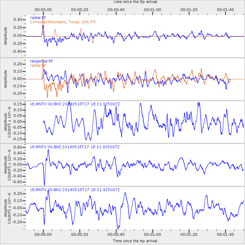
MNTX Cornudas Mountains, Texas, USA - Earthquake Result Viewer
*The percent match for this event was below the threshold and hence no stack was calculated.
| Earthquake location: |
Northern Chile |
| Earthquake latitude/longitude: |
-23.5/-68.6 |
| Earthquake time(UTC): |
2014/05/16 (136) 17:08:32 GMT |
| Earthquake Depth: |
103 km |
| Earthquake Magnitude: |
5.5 MWR |
| Earthquake Catalog/Contributor: |
NEIC PDE/NEIC COMCAT |
|
| Network: |
US United States National Seismic Network |
| Station: |
MNTX Cornudas Mountains, Texas, USA |
| Lat/Lon: |
31.70 N/105.38 W |
| Elevation: |
404 m |
|
| Distance: |
65.2 deg |
| Az: |
325.761 deg |
| Baz: |
142.687 deg |
| Ray Param: |
$rayparam |
*The percent match for this event was below the threshold and hence was not used in the summary stack. |
|
| Radial Match: |
66.695145 % |
| Radial Bump: |
400 |
| Transverse Match: |
50.397022 % |
| Transverse Bump: |
400 |
| SOD ConfigId: |
626651 |
| Insert Time: |
2014-05-30 18:02:57.504 +0000 |
| GWidth: |
2.5 |
| Max Bumps: |
400 |
| Tol: |
0.001 |
|
Signal To Noise
| Channel | StoN | STA | LTA |
| US:MNTX:00:BHZ:20140516T17:18:31.925007Z | 3.6908875 | 2.9934233E-7 | 8.1103074E-8 |
| US:MNTX:00:BH1:20140516T17:18:31.925007Z | 1.8353376 | 1.2737378E-7 | 6.940074E-8 |
| US:MNTX:00:BH2:20140516T17:18:31.925007Z | 0.9902284 | 7.0344996E-8 | 7.103916E-8 |
| Arrivals |
| Ps | |
| PpPs | |
| PsPs/PpSs | |


