You are here: Home > Network List > UW - Pacific Northwest Regional Seismic Network Stations List
> Station MRBL Marblemount, WA, USA > Earthquake Result Viewer
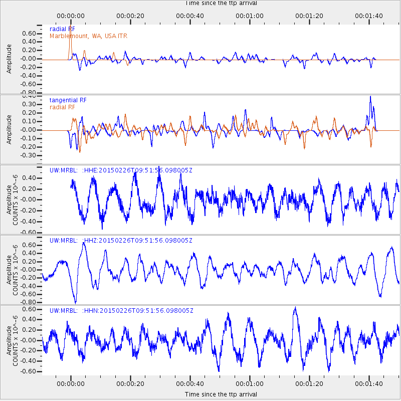
MRBL Marblemount, WA, USA - Earthquake Result Viewer
*The percent match for this event was below the threshold and hence no stack was calculated.
| Earthquake location: |
Andreanof Islands, Aleutian Is. |
| Earthquake latitude/longitude: |
50.1/-175.8 |
| Earthquake time(UTC): |
2015/02/26 (057) 09:45:37 GMT |
| Earthquake Depth: |
24 km |
| Earthquake Magnitude: |
5.2 MW |
| Earthquake Catalog/Contributor: |
ISC/ISC |
|
| Network: |
UW Pacific Northwest Regional Seismic Network |
| Station: |
MRBL Marblemount, WA, USA |
| Lat/Lon: |
48.52 N/121.48 W |
| Elevation: |
75 m |
|
| Distance: |
34.8 deg |
| Az: |
71.12 deg |
| Baz: |
293.543 deg |
| Ray Param: |
$rayparam |
*The percent match for this event was below the threshold and hence was not used in the summary stack. |
|
| Radial Match: |
69.55699 % |
| Radial Bump: |
400 |
| Transverse Match: |
66.58408 % |
| Transverse Bump: |
400 |
| SOD ConfigId: |
7019011 |
| Insert Time: |
2019-04-17 02:28:52.260 +0000 |
| GWidth: |
2.5 |
| Max Bumps: |
400 |
| Tol: |
0.001 |
|
Signal To Noise
| Channel | StoN | STA | LTA |
| UW:MRBL: :HHZ:20150226T09:51:56.098005Z | 2.4532864 | 4.7791957E-7 | 1.9480791E-7 |
| UW:MRBL: :HHN:20150226T09:51:56.098005Z | 1.1992693 | 2.0338263E-7 | 1.6958879E-7 |
| UW:MRBL: :HHE:20150226T09:51:56.098005Z | 1.0974207 | 2.7027878E-7 | 2.4628548E-7 |
| Arrivals |
| Ps | |
| PpPs | |
| PsPs/PpSs | |


